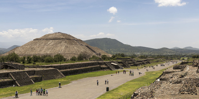
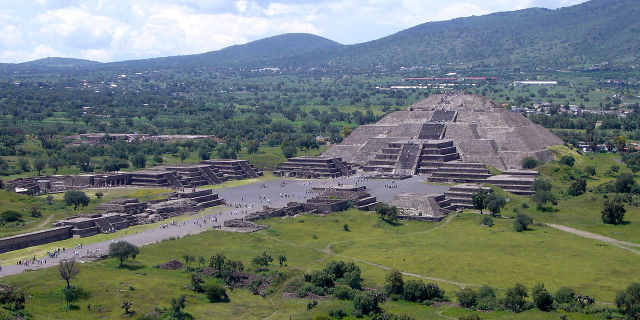
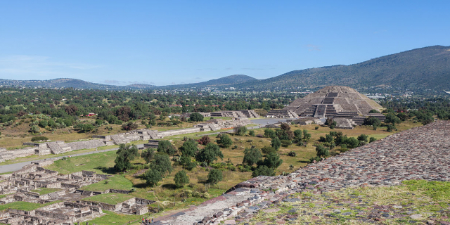
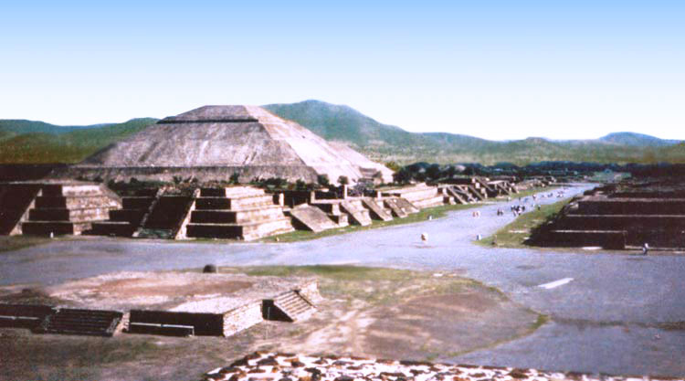
The Way of the Dead included about a hundred religious buildings. It forms the north-south axis of the city, more precisely it lies 15.5 degrees east of north, parallel to the front of the Pyramid of the Sun, and points to the sacred mountain of Cerro Gordo behind the Pyramid of the Moon. Its deviation allows the previously mentioned perpendicular east-west axis to follow exactly the path of the Pleiades constellation during the summer solstice. The Way of the Dead is 40 meters wide and stretched for 2.5-3.2 km from Moon Square in the north to the Citadel and the Market Square in the south. According to the French archaeologist René Millon, it once stretched even further, up to the mountains. The grade divided the city into two parts and was symmetrically lined with temples, palaces and residential buildings. One suggests that the construction of the ...Read more
The Way of the Dead included about a hundred religious buildings. It forms the north-south axis of the city, more precisely it lies 15.5 degrees east of north, parallel to the front of the Pyramid of the Sun, and points to the sacred mountain of Cerro Gordo behind the Pyramid of the Moon. Its deviation allows the previously mentioned perpendicular east-west axis to follow exactly the path of the Pleiades constellation during the summer solstice. The Way of the Dead is 40 meters wide and stretched for 2.5-3.2 km from Moon Square in the north to the Citadel and the Market Square in the south. According to the French archaeologist René Millon, it once stretched even further, up to the mountains. The grade divided the city into two parts and was symmetrically lined with temples, palaces and residential buildings. One suggests that the construction of the Road of the Dead could have been precisely planned from the earliest stages of construction. Its main area was located between the Pyramid of the Moon and the Rio San Juan Canal. It had talud-tablero-style platforms on the sides, which, in addition to providing access to it, acted as an efficient drainage system that also sat below grade, draining the buildings on either side.
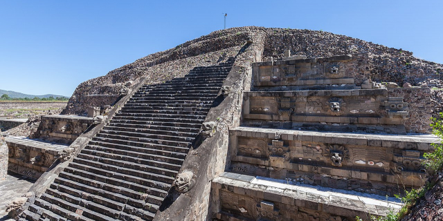
Its architectural appearance testifies to the incredible surveying technique of the builders. From north to south, the path has a thirty-meter slope, which the architects overcame with evenly spaced steps. After every fifty meters there are seven steps, at the foot of which there is a platform. This technique puts the observer in an optical illusion. From bottom to top, or from south to north, an endless staircase can still be seen today, which at the end of the path seems to turn into the pyramid of the moon. However, when looking in the opposite direction, all stairs and platforms disappear imperceptibly. Below, only the light brown, kilometers-long ribbon of the Path of the Dead is visible.


![[node:title]](/sites/default/files/styles/640x320/public/default_images/default_0.JPG?itok=nAKl_DR1)
Add new comment