道頓堀
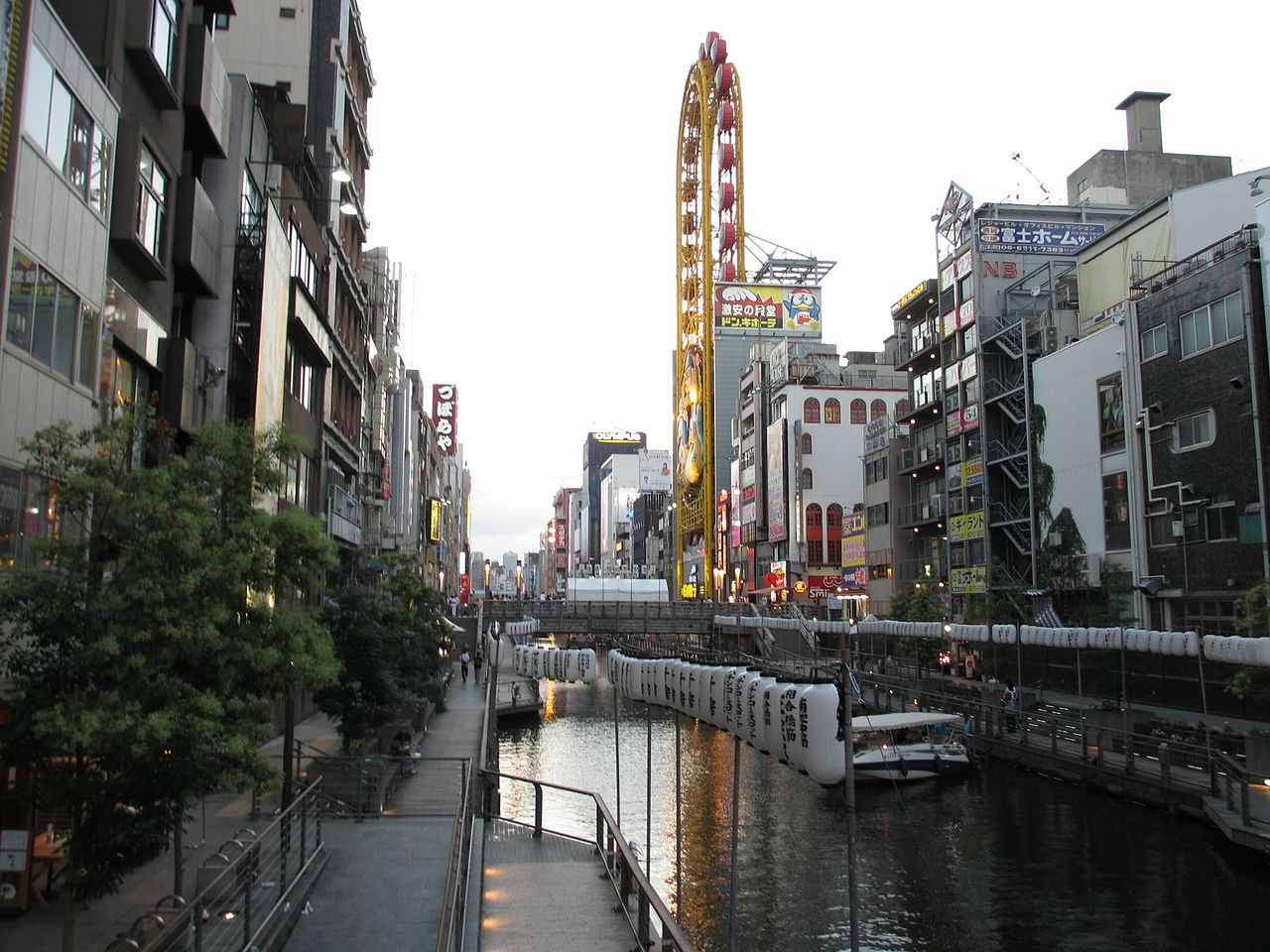
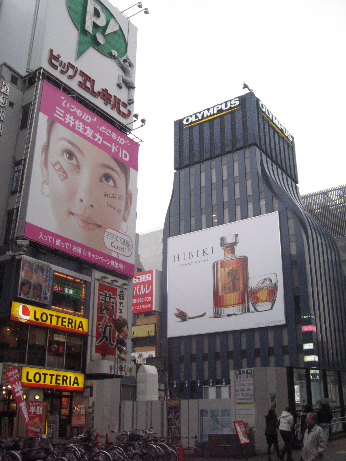
( Dōtonbori )Dōtonbori or Dōtombori (道頓堀, pronounced [doːtomboɾi]) is a district in Osaka, Japan. Known as one of Osaka's principal tourist and nightlife areas, the area runs along the Dōtonbori canal from Dōtonboribashi Bridge to Nipponbashi Bridge in the Namba district of the city's Chūō ward. Historically a theater district, it is now a popular nightlife and entertainment area characterized by its eccentric atmosphere and large illuminated signboards.
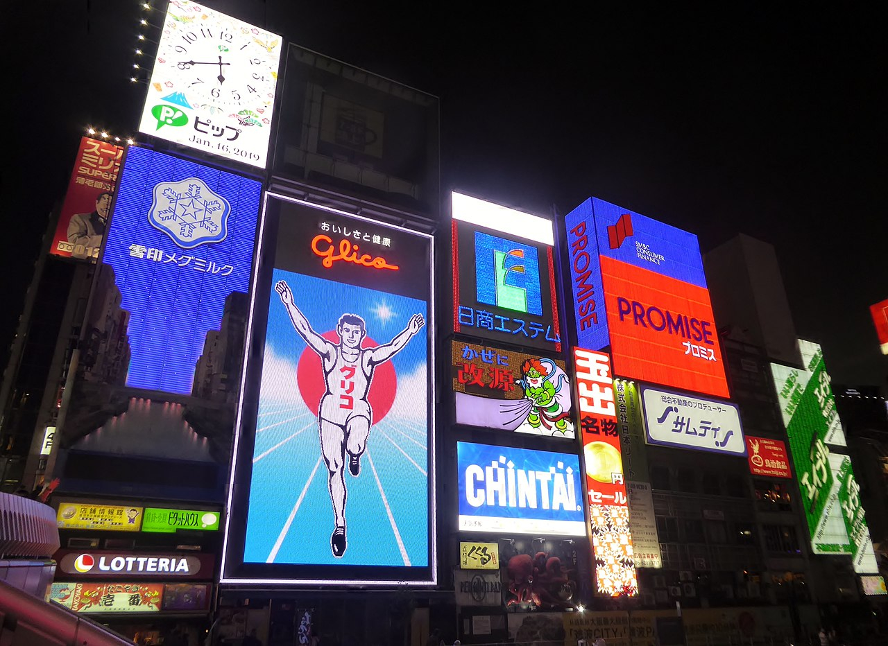
One of the area's most prominent features is an illuminated billboard for confectionery company Glico displaying the image of a runner crossing a finishing line, which is often seen as an icon of Osaka within Japan.

Dōtonbori traces its history back to 1612, when the administrator of local canals, Nariyasu Dōton, began construction of the canal on the southern edge of Osaka. Nariyasu Dōton was joined by Yasui Jihē, Yasui Kuhē, and Hirano Tōjirō. Construction was interrupted: Yasui Jihē died after an illness and Nariyasu Dōton died during the Siege of Osaka in summer 1615, having fought on the losing side of Toyotomi Hideyori. Yasui Kuhē and Hirano Tōjirō continued construction and the canal was completed by September 1615.[1] The new lord of Osaka Castle, Matsudaira Tadaaki, named the canal and avenue beside it Dōtonbori ("bori" from "hori", meaning "canal"), even though Nariyasu Dōton had been on the losing side during the siege.
Over time, the story changed to credit the canal to a fictional local entrepreneur, Yasui Dōton. According to the revised story, Yasui Dōton began expanding the tiny Umezu River at his own expense in 1612, hoping to increase commerce in the region by connecting the two branches of the Yokobori River with a canal running east–west. He also died during the Siege of Osaka and his cousin finished the canal in 1615.[2] The popularity of the revised story resulted in a stone monument erected for Yasui Dōton in 1915 at the north end of Nipponbashi. In the 1965 Dōtonbori Trial (道頓堀裁判) disputing the ownership rights of the canal, it was determined that Yasui Dōton was a fictional character,[3] based on Yasui family records dating back to the 1600s.[1]
The character of Dōtonbori became defined in 1621 when the Tokugawa Shogunate instituted urban planning and designated Dōtonbori as the entertainment district of Osaka. Yasui Kuhē is credited with luring playhouses and performance tents to the district, and the theatre owners rewarded the Yasui family by reserving a box for each performance.[1] By 1662, the avenue boasted six Kabuki theatres and five Bunraku theatres, as well as the unique Takeda Karakuri mechanical puppet theatre. Many restaurants and cafes were built to cater to the flood of tourists and entertainment-seekers pouring nightly into Dōtonbori.[citation needed]

Over the years, declining interest in traditional forms of entertainment led to the closing of most of Dōtonbori's original attractions. With the exception of the Osaka Shochikuza, its remaining theatres were all destroyed during World War II.[4]
A redevelopment project was started in the 1960s to improve water quality in the canal. Land on the north and south banks was reclaimed to raise the river walls, and to partially fund the project, half the reclaimed land was sold to the owners of the land next to the canal. The other half was designated as a greenbelt parkway. The Dōtonbori Trial began when the descendants of Yasui Kuhē, one of the two people who had completed the canal in 1615, filed suit against the city and prefectural governments over ownership rights to the land along the canal.[1]
Further development of the land bordering the canal began in 2001, and the 170 metres (560 ft) between Tazaemonbashi and Ebisubashi was opened to the public in 2004.[3] Prior to that time, development along the canal primarily focused on the streets parallel to it (Dōtonbori Street on the south bank, and Sōemonchō Street on the north bank), and very few storefronts faced the canal itself.[5]


Add new comment