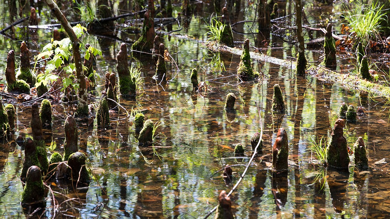
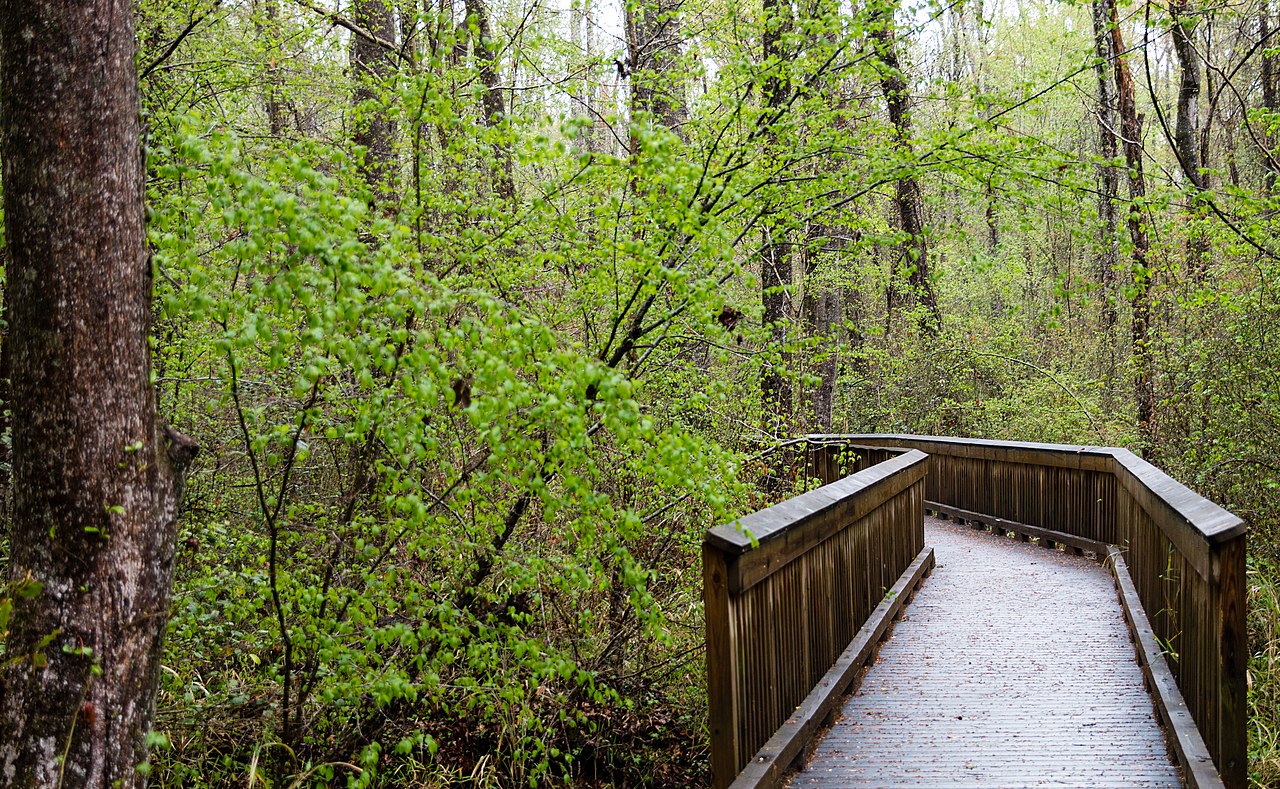
Great Dismal Swamp
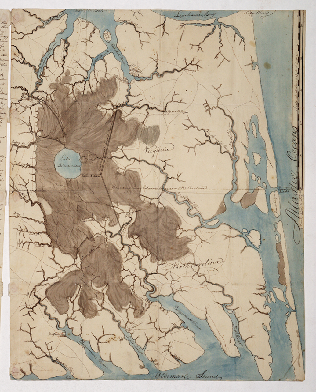
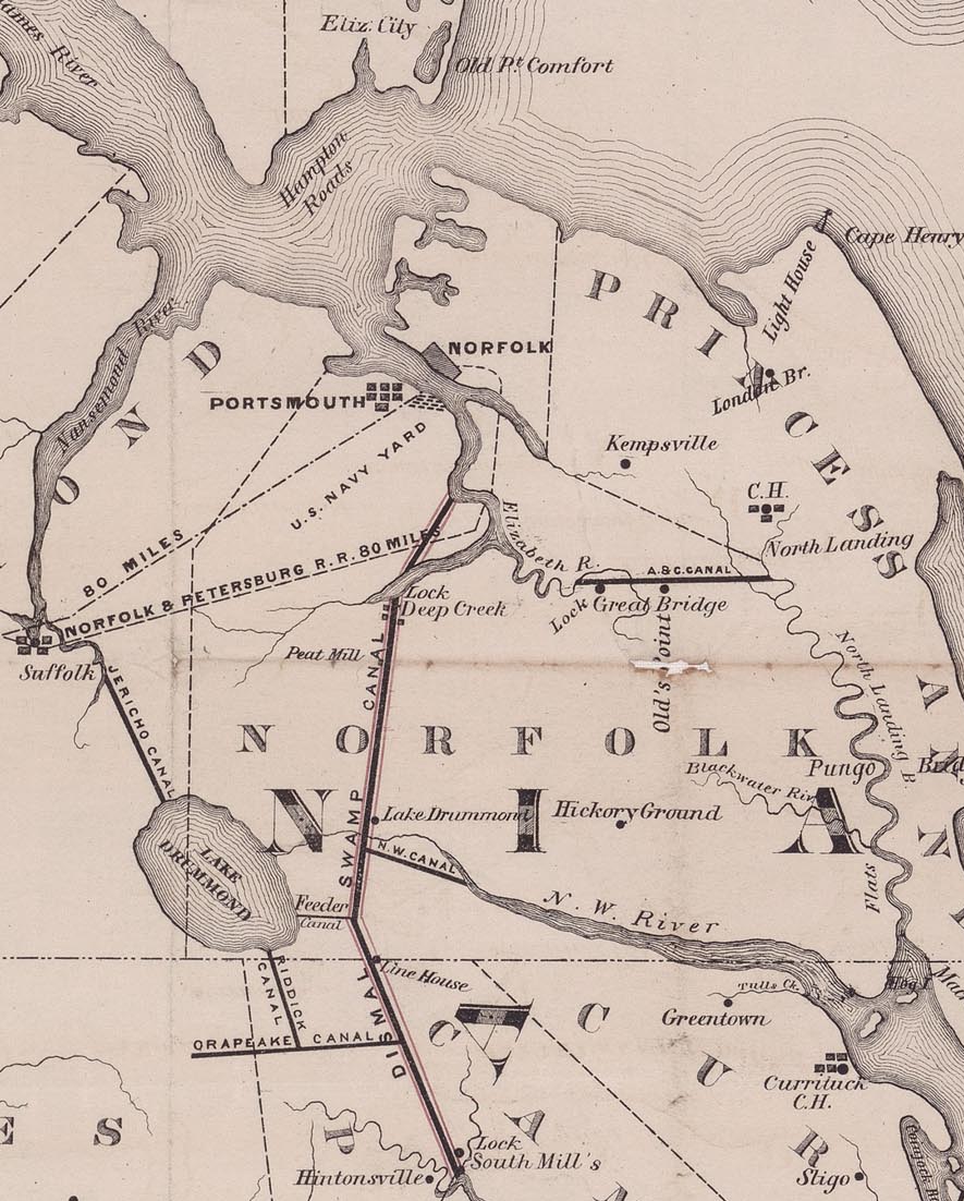
The Great Dismal Swamp is a large swamp in the Coastal Plain Region of southeastern Virginia and northeastern North Carolina, between Norfolk, Virginia, and Elizabeth City, North Carolina. It is located in parts of the southern Virginia independent cities of Chesapeake and Suffolk and northern North Carolina counties of Gates, Pasquotank, and Camden. Some estimates place the original size of the swamp at over one million acres (4,000 km2). As of 2022 the size of the Great Dismal Swamp is around 750 square miles (480,000 acres; 1,900 km2).
Lake Drummond, a 3,100-acre (13 km2) natural lake, is located in the heart of the swamp. Lake Drummond is a circular body of water, and is one of only two naturally occurring freshwater lakes in Virginia. Along the Great Dismal Swamp's eastern edge runs the Dismal Swamp Canal. The canal is 22 miles long, and was completed in 1805 to provide a pathway for trade between Chesapeake Bay, Virginia ...Read more
The Great Dismal Swamp is a large swamp in the Coastal Plain Region of southeastern Virginia and northeastern North Carolina, between Norfolk, Virginia, and Elizabeth City, North Carolina. It is located in parts of the southern Virginia independent cities of Chesapeake and Suffolk and northern North Carolina counties of Gates, Pasquotank, and Camden. Some estimates place the original size of the swamp at over one million acres (4,000 km2). As of 2022 the size of the Great Dismal Swamp is around 750 square miles (480,000 acres; 1,900 km2).
Lake Drummond, a 3,100-acre (13 km2) natural lake, is located in the heart of the swamp. Lake Drummond is a circular body of water, and is one of only two naturally occurring freshwater lakes in Virginia. Along the Great Dismal Swamp's eastern edge runs the Dismal Swamp Canal. The canal is 22 miles long, and was completed in 1805 to provide a pathway for trade between Chesapeake Bay, Virginia and the Albemarle Sound in North Carolina. The largest water supply for the Dismal Swamp Canal is through Lake Drummond.
The Great Dismal Swamp National Wildlife Refuge was created in 1973 when the Union Camp Corporation of Franklin, Virginia, donated 49,100 acres (19,900 ha) of land after centuries of logging and other human activities devastated the swamp's ecosystems. The refuge was officially established through the Dismal Swamp Act of 1974, and consists of over 167 square miles (433 square km) of forested wetlands. Outside the boundaries of the refuge, the state of North Carolina has preserved and protected additional portions of the swamp through the establishment of the Dismal Swamp State Park. That park protects 22 square miles (57 km2) of forested wetland.
The swamp was a refuge location for the Great Dismal Swamp maroons, including enslaved people in the Southern states before the American Civil War, and Native Americans who were escaping colonial expansion. Prior to the maroons inhabiting the swamp, it was inhabited by Algonquian-speaking Native American coastal tribes.
A 45,611-acre (184.58 km2) remnant of the original swamp was declared a National Natural Landmark in 1973, in recognition of its unique combination of geological and ecological features.
 Fugitive Slaves in the Dismal Swamp, 1888, by David Edward Cronin
 Great Dismal Swamp Canal
The origin of Lake Drummond is not entirely clear as there is no apparent network of natural streams emptying into the lake.[1]
Archaeological evidence suggests varying cultures of humans have inhabited the swamp for 13,000 years. The Powhatan empire extended to the northern edge of the Great Dismal Swamp around the time of the settling of Jamestown, displacing the Chesapeake tribe residing there before.[2] In 1650, Algonquian-speaking Native Americans of coastal tribes lived in the swamp. In 1665, William Drummond, the first governor of North Carolina, was the first European recorded as discovering the swamp's lake, which was subsequently named for him.[3] In 1728, William Byrd II, while leading a land survey to establish a boundary between the Virginia and North Carolina colonies, made many observations of the swamp, none of them favorable; he is credited with naming it the Dismal Swamp.[3] At this time, the swamp was estimated to cover around 2,000 square miles.[4] Settlers did not appreciate the ecological importance of wetlands. In 1763, George Washington visited the area, and he and others founded the Dismal Swamp Company in a venture to drain the swamp and clear it for settlement.[5] The company later turned to the more profitable goal of timber harvesting.[6]
Based on archeological findings, Native American communities fled to the Swamp for refuge from the colonial frontier.[7] Along with the Native American communities, there were also multiple populations of Africans and African Americans taking refuge in the Swamp in early American History, many of them fleeing slavery due to the Atlantic slave trade. These Great Dismal Swamp maroons consisted of thousands of escaped Black refugee slaves by the year 1860.[8][9] They were able to find shelter, community and society in the swamp that was not readily available in the world outside the swamp. J.D. Smyth wrote of the maroons in his 1784 novel: A Tour in the United States, "Run-away(s) have resided in these places for twelve, twenty, or thirty years and upwards, subsisting themselves upon corn, hogs, and fowls that they raised on some of the spots not perpetually under water, nor subject to be flooded, as forty-nine parts out of fifty are; and on such spots they have erected habitations and cleared small fields around them."[10] Excavations reveal island communities existing until the Civil War.[11] Charlie, a maroon who worked illegally in a lumber camp in the swamp, later recalled that there were whole families of maroons living in the Dismal Swamp, some of whom had never seen a White man.[12] The Underground Railroad Education Pavilion, an exhibit set up to educate visitors about the fugitive slaves who lived in the swamp, was opened February 24, 2012.[13]
The Dismal Swamp Canal was authorized by Virginia in 1787 and by North Carolina in 1790. Construction began in 1793 and was completed in 1805. The canal, as well as a railroad constructed through part of the swamp in 1830, enabled the harvest of timber.[14] The canal deteriorated after the Albemarle and Chesapeake Canal was completed in 1858. In 1929, the United States Government bought the Dismal Swamp Canal and began to improve it. The canal remains the oldest operating artificial waterway in the country. Like the Albemarle and Chesapeake canals, it is part of the Atlantic Intracoastal Waterway.[3]

![[node:title]](/sites/default/files/styles/640x320/public/default_images/default_0.JPG?itok=nAKl_DR1)


 - CC BY-SA 3.0")


 - CC BY-SA 3.0")


Add new comment