Luang Prabang
Luang Phabang, (Lao: ຫລວງພະບາງ/ຫຼວງພະບາງ) or Louangphabang (pronounced [lǔaŋ pʰa.bàːŋ]), commonly transliterated into Western languages from the pre-1975 Lao spelling ຫຼວງພຣະບາງ (ຣ = silent r) as Luang Prabang, literally meaning "Royal Buddha Image", is a city in north central Laos, consisting of 58 adjacent villages, of which 33 comprise the UNESCO Town of Luang Prabang World Heritage Site. It was listed in 1995 for unique and "remarkably" well preserved architectural, religious and cultural heritage, a blend of the rural and urban developments over several centuries, including the French colonial influences during the 19th and 20th centuries.
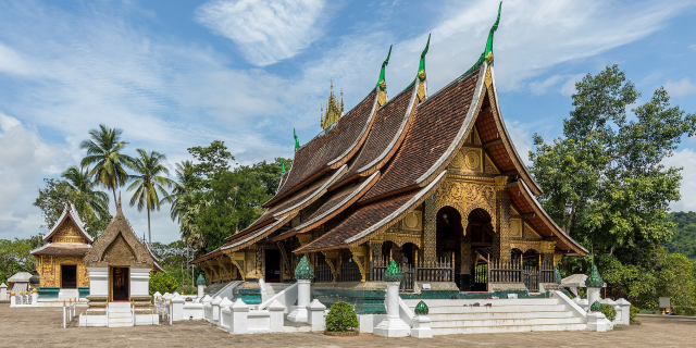
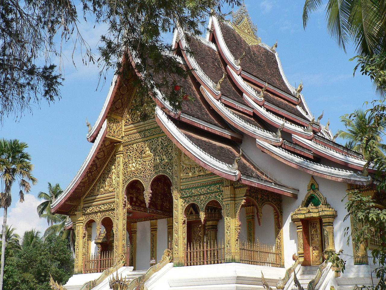
The centre of the city consists of four main roads and is located on a peninsula at the confluence of the Nam Khan and Mekong River. Luang Prabang is well known for its numerous Buddhist temples and monasteries. Every morning, hundr...Read more
Luang Phabang, (Lao: ຫລວງພະບາງ/ຫຼວງພະບາງ) or Louangphabang (pronounced [lǔaŋ pʰa.bàːŋ]), commonly transliterated into Western languages from the pre-1975 Lao spelling ຫຼວງພຣະບາງ (ຣ = silent r) as Luang Prabang, literally meaning "Royal Buddha Image", is a city in north central Laos, consisting of 58 adjacent villages, of which 33 comprise the UNESCO Town of Luang Prabang World Heritage Site. It was listed in 1995 for unique and "remarkably" well preserved architectural, religious and cultural heritage, a blend of the rural and urban developments over several centuries, including the French colonial influences during the 19th and 20th centuries.
The centre of the city consists of four main roads and is located on a peninsula at the confluence of the Nam Khan and Mekong River. Luang Prabang is well known for its numerous Buddhist temples and monasteries. Every morning, hundreds of monks from the various monasteries walk through the streets collecting alms. One of the city's major landmarks is Mount Phou Si; a large steep hill which despite the constrained scale of the city, is 150 metres (490 ft) high; a steep staircase leads to Wat Chom Si shrine and an overlook of the city and the rivers.
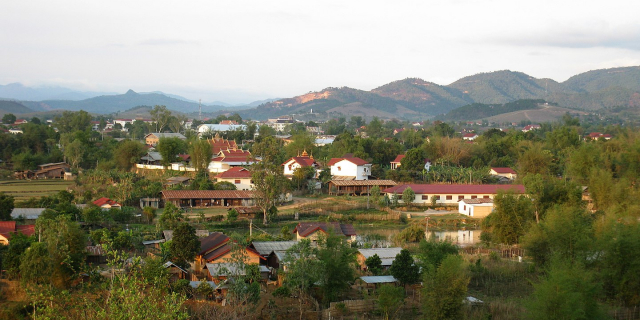
The city was formerly the capital of a kingdom of the same name. It had also been known by the ancient name of Xieng Thong. It was the royal capital and seat of government of the Kingdom of Laos, until the Pathet Lao takeover in 1975. The city is part of Luang Prabang District of Luang Prabang Province and is the capital and administrative centre of the province. It lies approximately 300 km (190 mi) north of the capital Vientiane. Currently, the population of the city as a whole is roughly 56,000 inhabitants with the UNESCO protected site being inhabited by around 24,000.
By the 6th century in the Chao Phraya River Valley, Mon peoples had coalesced to create the Dvaravati kingdoms. In the north, Haripunjaya (Lamphun) emerged as a rival power to the Dvaravati. By the 8th century the Mon had pushed north to create city states, in Fa Daet (modern Kalasin, northeastern Thailand), Sri Gotapura (Sikhottabong) near modern Tha Khek, Laos, Muang Sua (Luang Prabang), and Chantaburi (Vientiane). In the 8th century CE, Sri Gotapura (Sikhottabong) was the strongest of these early city states, and controlled trade throughout the middle Mekong region. The city states were loosely bound politically, but were culturally similar and introduced Therevada Buddhism from Sri Lankan missionaries throughout the region.[1][2][3][4]: 6, 7 [5][6]
 View of Luang Prabang, 1897Lan Xang period
Xieng Dong Xieng Thong experienced a brief period of Khmer suzerainty under Jayavarman VII from 1185 to 1191. By 1180 the Sipsong Panna had regained their independence from the Khmers[citation needed], however, and in 1238 an internal uprising in the Khmer outpost of Sukhothai expelled the Khmer overlords. Xieng Dong Xieng Thong in 1353 became the capital of the Lan Xang kingdom. In 1359 the Khmer king from Angkor gave the Phra Bang to his son-in-law, the first Lang Xang monarch Fa Ngum (1353-1373); to provide Buddhist legitimacy both to Fa Ngum's rule and by extension to the sovereignty of Laos and was used to spread Theravada Buddhism in the new kingdom. The capital name was changed to Luangphabang, where it was kept, named after the Buddha image.[7]: 225–226 Luang Prabang was briefly occupied by the Vietnamese forces during Emperor Lê Thánh Tông's 1478–1480 expedition against Lan Xang and Lanna.[8] The capital was moved in 1560 by King Setthathirath I to Vientiane, which remains the capital today.
 Market in Luang Prabang, pre-1901
In 1707, Lan Xang fell apart because of a dynastic struggle and Luang Prabang became the capital of the independent Kingdom of Luang Phrabang. When France annexed Laos, the French recognised Luang Prabang as the royal residence of Laos. Eventually, the ruler of Luang Prabang became synonymous with the figurehead of Laos. When Laos achieved independence, the king of Luang Prabang, Sisavang Vong, became the head of state of the Kingdom of Laos.[9]
World War II Damage caused by a communist ground attack on Luang Prabang airfield, 1967
The town was the scene of many events during and in the aftermath of World War II and it was occupied by several foreign countries during the war (Vichy France, Thailand, Imperial Japan, Free France, and Nationalist China). Initially the Vichy French controlled the city but lost it to Thai forces following the Franco-Thai War of 1940–1941. On 9 March 1945, a nationalist group declared Laos once more independent, with Luang Prabang as its capital but on 7 April 1945 two battalions of Japanese troops occupied the city.[10] The Japanese attempted to force Sisavang Vong (the King of Luang Prabang) to declare Laotian independence but on 8 April he instead simply declared an end to Laos' status as a French protectorate. The King then secretly sent Prince Kindavong to represent Laos to the Allied forces and Sisavang Vatthana as representative to the Japanese.[10] Following Japan's surrender to the Allies, Free French forces were sent to reoccupy Laos and entered Luang Prabang on 25 August, at which time the King assured the French that Laos remained a French colonial protectorate.[10] In September the Chinese Nationalist forces arrived to receive the surrender of the remaining Japanese forces but also quickly set about buying up the Laotian opium crop.[10]
Laotian Civil War eraIn April and May 1946, the French attempted to recapture Laos by using paratroops to retake Vientiane and Luang Prabang and drive Phetsarath and the Lao Issara ministers out of Laos and into Thailand and Vietnam. During the First Indochina War, the Viet Minh and Pathet Lao forces attempted to capture the city several times in 1953 and 1954, but were stopped before they could reach it by French forces.[11] During the Laotian Civil War of the 1950s, 60s, and 70s, a secret American airbase was located at Luang Prabang[citation needed] and it was the scene of fighting. Luang Prabang remained the royal capital until 1975, when the Pathet Lao communist forces seized power with North Vietnamese support and dissolved the monarchy.


Add new comment