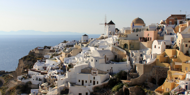
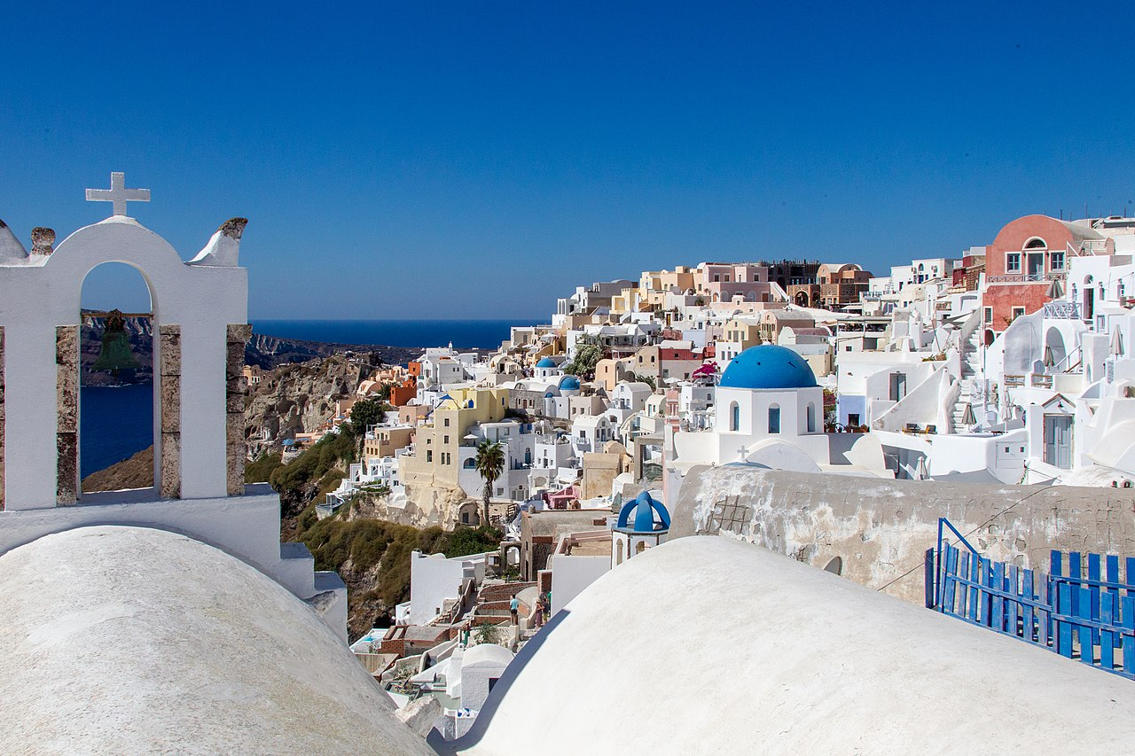
Οία Θήρας
( Oia, Greece )Oia or Ia (Greek: Οία, romanized: Oía, pronounced [ˈia]) is a small village and former community in the South Aegean on the islands of Thira (Santorini) and Therasia, in the Cyclades, Greece. Since the 2011 local government reform it has been part of the municipality of Santorini, of which it is a municipal unit. It covers the whole island of Therasia and the northwesternmost part of Santorini, which it shares with the municipal unit of Santorini. The main street is named Nikolaou Nomikou. The population was 1,545 inhabitants at the 2011 census, and the land area is 19.449 km2.
Oia was previously known as Apano Meria (Απάνω Μεριά or Επάνω Μεριά, "upper side"), a name which still occurs locally as Pano Meria, and the inhabitants are still called Apanomerites (Απανωμερίτες). The Ancient Greek Oia wa...Read more
Oia or Ia (Greek: Οία, romanized: Oía, pronounced [ˈia]) is a small village and former community in the South Aegean on the islands of Thira (Santorini) and Therasia, in the Cyclades, Greece. Since the 2011 local government reform it has been part of the municipality of Santorini, of which it is a municipal unit. It covers the whole island of Therasia and the northwesternmost part of Santorini, which it shares with the municipal unit of Santorini. The main street is named Nikolaou Nomikou. The population was 1,545 inhabitants at the 2011 census, and the land area is 19.449 km2.
Oia was previously known as Apano Meria (Απάνω Μεριά or Επάνω Μεριά, "upper side"), a name which still occurs locally as Pano Meria, and the inhabitants are still called Apanomerites (Απανωμερίτες). The Ancient Greek Oia was one of the two harbours of ancient Thera and was located in the southeast of the island, where Kamari is now.
Oia reached the peak of prosperity in the late 19th and early 20th centuries. Its economic prosperity was based on its merchant fleet, which plied trade in the Eastern Mediterranean, especially from Alexandria to Russia. The two-story captains' houses built on the highest part of the village are a reminder of the village's former affluence. Part of the town was destroyed by the 1956 earthquake.
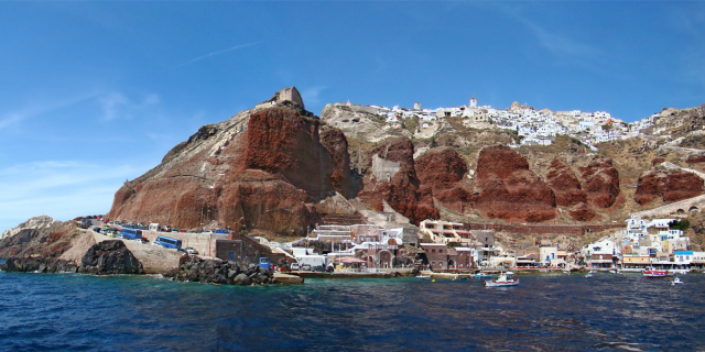
 View of the village towards the Byzantine castle ruins
 The village and its harbor at the sunset
The settlement of Oia had been mentioned in various travel reports before the beginning of Venetian rule, when Marco Sanudo founded the Duchy of Naxos in 1207 and feudal rule was instituted on Santorini.[1] Under the da Corogna family, Agios Nikolaos Kastell (Καστέλι του Αγίου Νικολάου), also called Apanomeria (Απανωμερία), was one of five local citadels. Its residential keep, Goulas, is now in the oldest part of the town, on its southwestern edge.[2]
In 1537, Hayreddin Barbarossa conquered the Aegean islands and placed them under Sultan Selim II.[3] However, Santorini remained under the Crispo family until 1566, passing then to Joseph Nasi and after his death in 1579 to the Ottoman Empire.
From the 16th to the 19th century, the settlement was designated Apanomeria on maps. In the mid-17th century, Jean de Thévenot uses the name Castelli San Nicolas. The name was changed to Oia in the second half of the 19th century.
In the late 19th and early 20th centuries, the town was a mariners' town that flourished as a result of seaborne trade throughout the Mediterranean, particularly as part of the trade route between Russia and Alexandria. In 1890 Oia had approximately 2,500 residents and approximately 130 sailing ships. There was a wharf in the bay of Armeni. Excellent wine was produced in quantity in the hinterland and exported to France amongst other places. However, the arrival of steam and the concentration of shipping at Piraeus caused the town's seagoing trade to collapse, and agriculture also diminished as increasing emigration took place, especially to Piraeus and Laurium. The economy of the town declined in the early 20th century on account of wars, economic depression and over extraction of fish resources.
The 7.8 magnitude[4] earthquake on 9 July 1956 caused considerable damage.[5] The epicentre of the strongest aftershock (magnitude 7.2) was located off the northern coast of Santorini.[4] The earthquake was followed by renewed emigration, and in 1977 Oia had only 306 inhabitants. After the earthquake, the village redeveloped into an attractive tourist town of the Cyclades, and is known as a "picture perfect" town which gets crowded with people during the summer season.[6][7]


Add new comment