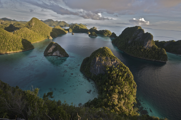
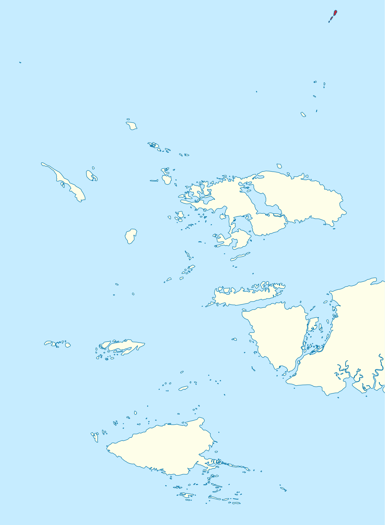
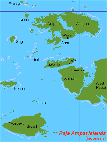
Raja Ampat, or the Four Kings, is an archipelago located off of the northwest tip of Bird's Head Peninsula (on the island of New Guinea), Southwest Papua province, Indonesia. It comprises over 1,500 small islands, cays, and shoals around the four main islands of Misool, Salawati, Batanta, and Waigeo, and the smaller island of Kofiau.
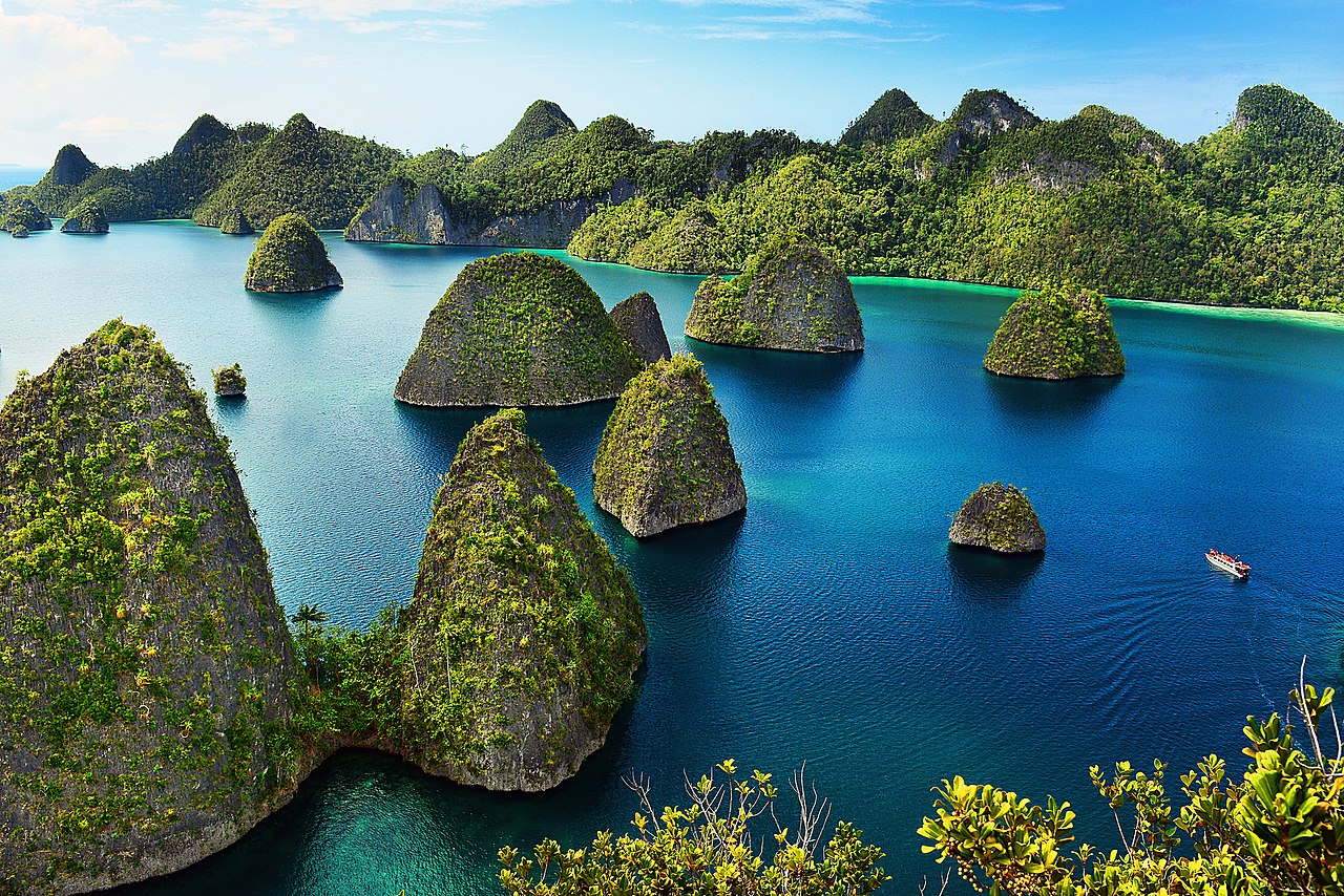
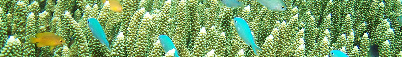
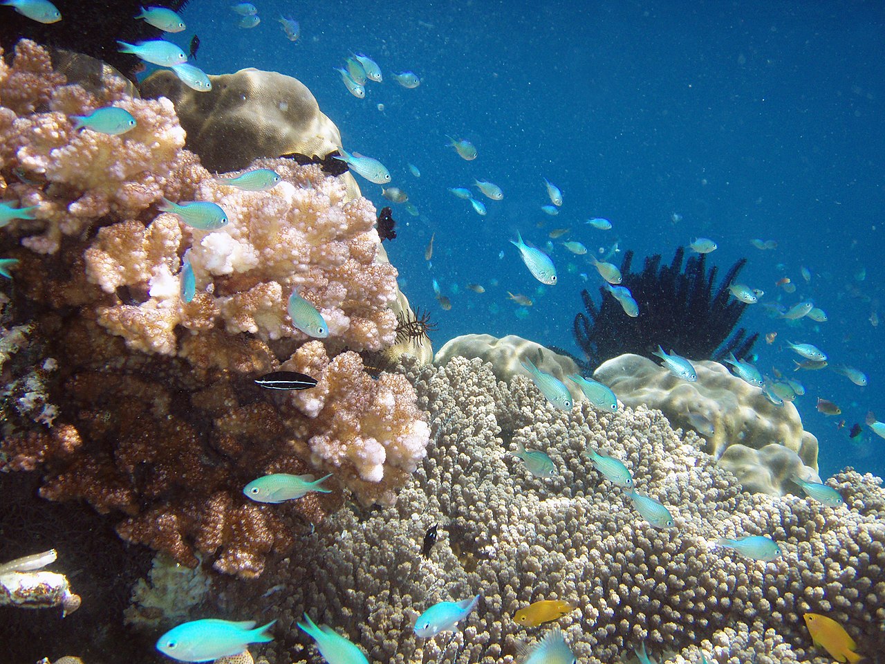
The Raja Ampat archipelago straddles the equator and forms part of the Coral Triangle, an area of Southeast Asian seas containing the richest marine biodiversity on earth. The Coral Triangle itself is an approximate area west-southwest of the Philippines, east-northeast and southeast of the island of Borneo, and north, east and west of the island of New Guinea, including the seas in between. Thousands of species of marine organisms, from the tiniest cleaner shrimp and camouflaged pygmy seahorses to the majestic cetaceans and whale sharks, thrive in these waters.
Administratively, the archipelago is part of the province of Sou...Read more
Raja Ampat, or the Four Kings, is an archipelago located off of the northwest tip of Bird's Head Peninsula (on the island of New Guinea), Southwest Papua province, Indonesia. It comprises over 1,500 small islands, cays, and shoals around the four main islands of Misool, Salawati, Batanta, and Waigeo, and the smaller island of Kofiau.
The Raja Ampat archipelago straddles the equator and forms part of the Coral Triangle, an area of Southeast Asian seas containing the richest marine biodiversity on earth. The Coral Triangle itself is an approximate area west-southwest of the Philippines, east-northeast and southeast of the island of Borneo, and north, east and west of the island of New Guinea, including the seas in between. Thousands of species of marine organisms, from the tiniest cleaner shrimp and camouflaged pygmy seahorses to the majestic cetaceans and whale sharks, thrive in these waters.
Administratively, the archipelago is part of the province of Southwest Papua. Most of the islands constitute the Raja Ampat Regency, which was separated from Sorong Regency in 2004. The regency encompasses around 70,000 square kilometres (27,000 sq mi) of land and sea, of which 8,034.44 km2 constitutes the land area and has a population of 64,141 at the 2020 Census; the official estimate as at mid 2022 was 66,839. This excludes the southern half of Salawati Island, which is not part of this regency but instead constitutes the Salawati Selatan and Salawati Tengah Districts of Sorong Regency.
 Raja Ampat Islands featured on the reverse of the 100,000 rupiah banknote
The name of Raja Ampat (Raja means king, and empat means four) comes from local mythology that told of a woman who found seven eggs, in one version this woman was Boki Tabai, daughter of Al-Mansur of Tidore and wife to Gurabesi. Three of the seven hatched and became kings who occupied Raja Ampat Islands, the fourth hatched and settled in Waigama but later migrated to Kalimuri (Seram). In another version, the fifth egg hatched into a woman (Pin Take) who later washed away to Biak, married Manar Makeri, and later gave birth to Gurabesi. The sixth egg hatched into a spirit, while the seventh egg did not hatch and turned to stone and worshipped as a king in Kali Raja (Wawiyai, Waigeo). Historically the 'four' kingdoms were Waigeo, Salawati, Sailolof, Misool, and Waigama. Locally Waigama is not considered one of the Raja Ampat, while Sailolof is not considered one of the Raja Ampat by Tidore.[1]
The first recorded sighting and landing by Europeans of the Raja Ampat Islands was by the Portuguese navigator Jorge de Menezes and his crew in 1526, en route from Biak, the Bird's Head Peninsula, and Waigeo, to Halmahera (Ternate).
Islam first arrived in the Raja Ampat Islands in the 15th century due to political and economic contacts with the Bacan Sultanate.[2] During the 16th and 17th centuries, the Maluku-based Sultante of Tidore had close economic and political ties with the islands, especially with Gurabesi.[2][3] During this period, Islam became firmly established, and local chiefs began adopting Islam.[3]
As a consequence of these ties, Raja Ampat was considered a part of the Sultanate of Tidore. After the Dutch invaded Maluku, it was claimed by the Netherlands.
The English explorer William Dampier gave his name to Dampier Strait, which separates Batanta Island from Waigeo Island. To the east, there is a strait that separates Batanta from Salawati. In 1759 Captain William Wilson sailing in the East Indiaman Pitt navigated these waters and named a strait the 'Pitt Strait', after his vessel; this was probably the channel between Batanta and Salawati.


Add new comment