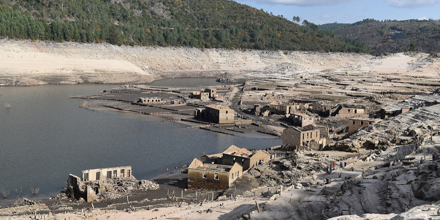
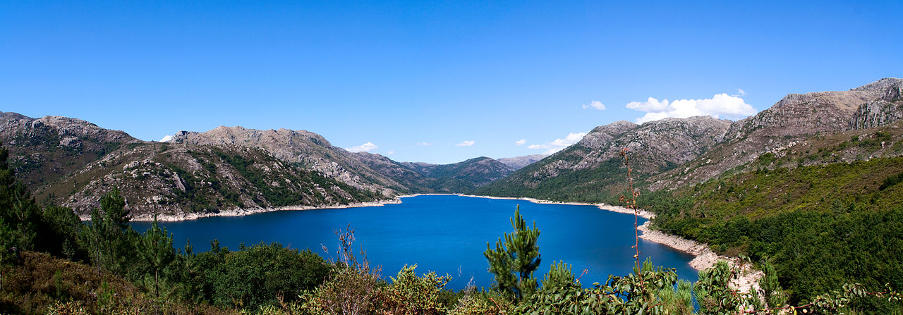
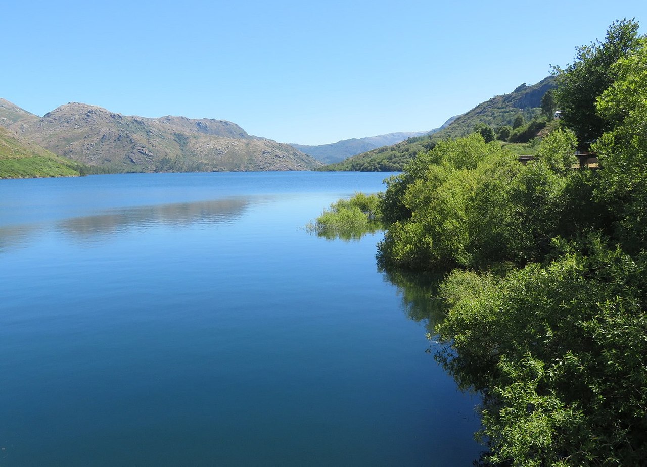
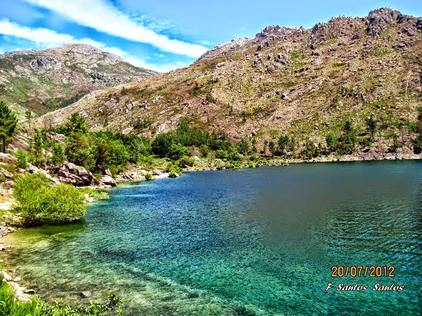
Vilarinho da Furna (alternately called Vilarinho das Furnas) was a former-village, located in the civil parish of Campo de Gerês, in the municipality of Terras de Bouro, in the northern Portuguese district of Braga. Located on margins of River Homem and Ribeira do Eido, in 1972, it was intentionally submerged by the Portuguese State during the course of filling of a reservoir of the same name. Although still legally held by the former-villages, the lands are inundated, and only visible during the dry season, when it emerges, becoming a tourist attraction.
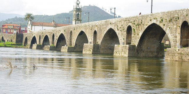
Oral tradition suggests that the village was founded within the 1st century (c.70),[1] during the Visigothic settlement of the region,[1][2] a time when the nearby Roman road (Via Nova XVIII) was extended. According to this history, seven men settled present-day Portela do Campo, but following a dispute, four decided to settle downstream of the Rio Homem, establishing Vilarinho da Furna. Little evidence exists to support this story, although there are several Roman roads and bridges within the region, including two roads to the south and three bridges (one within the village that crosses the Ribeira do Eido, one upstream (the Ponta Nova) and one downstream (Ponte do Couço).[3][4]
Little is known about its status during the Roman occupation, although it was first referenced in 1623, in the church register of baptisms.[3][5]
A German who visited Vilarinho da Furna in the final years of the 18th century noted that the houses were comparable to other peasants in the region. However, his large, host family lived comfortably; in contrast to many other places, they had no shortage of food, and their beds were clean and made-up with white linens. He suggested that many German peasants would envy how well-off they were (Link, 1803 mentioned in Cleto, 2001).[2]
FloodPlanning for a reservoir and dam began in the 1950s, with surveys and test drilling. Construction started in 1967. At this time, the village had almost 300 inhabitants in 57 families spread over 80 houses.[2]
The exodus started in September 1969, when the then-Companhia Portuguesa de Electricidade (Portuguese Electricity Company) started to pay out the indemnity fees to the villages residents. The villagers received a total of 20,741,607 escudos: excluding houses and other structures, the land itself was valued by HICA - Companhia Hidroeléctrica do Cavado (Cavado Hydroelectric Company) at .5 escudos 1 square metre (11 sq ft), equivalent to the price of half a sardine.[1] When including all structures, the compensation was equivalent to 5 escudos 1 square metre (11 sq ft), which was less than the cost that HICA incurred to build houses for its workers.[6] In October 1970, notices were posted throughout the village stating that the reservoir would be filled.[3] Before the dam was built, all roads leading to the village were constructed by the villagers. The dam construction company attempted to build a new road to evacuate the villagers, but this attempt failed. In the end, the villagers had to construct a new road to allow them to take their belongings by truck from the village. Residents tried to bring away as much of their belongings as possible (even the roof tiles); only the bare walls of most of the houses were left behind.[1] The last inhabitant left in 1971, and the village was submerged the following year.[1]
The reservoir covers an area of approximately 344 hectares (37,000,000 sq ft), with a useful reservoir capacity of 69.7 cubic hectometres (2.46×10⁹ cu ft), as well as a maximum power capacity of 125 MW.[7]
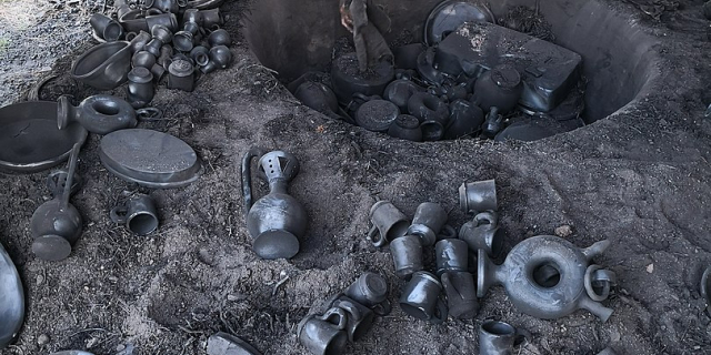
AftermathIn 1981, the municipality of Terras de Bouro built an Ethnographic museum in São João do Campo that commemorates the history of Vilarinho da Furna. The collection includes clothes, agricultural tools, and paintings depicting daily life in the village. The museum was built with stones from two houses of the old village. It was opened by Prime Minister Aníbal Cavaco Silva on 14 May 1989.[1]
In 2008, Terras de Bouro launched the project Valorização do Espaço Natural da Serra da Amarela (Serra da Amarela Natural Space Appreciation), based on the Parque Natural de Vilarinho da Furna (Nature Park of Vilarinho da Furna) that includes an underwater museum, a glass-bottom boat and wharf, a wildlife observation post, two mountain shelters, water and solar energy installations to provide energy for the park, beehives, a campsite and a bike path, as well as the re-reconstruction of the old bridge at Couço and the watermills in the area. The project was approved in July 2008 and funded 1.2 million euros budget over a period of 2 years, although it is estimated that another 2-3 million Euros would be needed to cover the expenses of the buildings and access roads. The municipalities of Terras de Bouro and Ponte da Barca also jointly developed a hiking route along Serra da Amarela that crossed Chã da Fonte, Casa da Neve, Branca de Bilhares, Entre-ambos-os-Rios, Germil, Brufe, Casarotas, Fojo do Lobos and back to Vilarinho da Furna.[8]
In October 1985, the former villagers created the Associação dos Antigos Habitantes de Vilarinho da Furna (Association of Former-Inhabitants of Vilarinho da Furna) to defend and promote the cultural, collective and communitarian heritage of the people of the old village. Some of its goals, such as the reforestation of the old lands, the creation of animal reserve, the development of an underwater museum and tourist activities, have been realized by the organization.


 - CC BY-SA 3.0")

![[node:title]](/sites/default/files/styles/640x320/public/default_images/default_0.JPG?itok=nAKl_DR1)


Add new comment