Großglockner-Hochalpenstraße
( Grossglockner High Alpine Road )
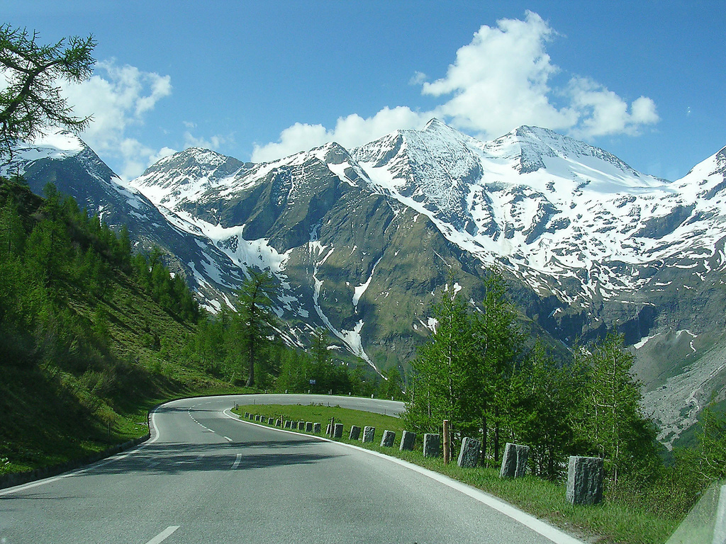
The Grossglockner High Alpine Road (in German Großglockner Hochalpenstraße) is the highest surfaced mountain pass road in Austria. It connects Bruck in the state of Salzburg with Heiligenblut in Carinthia via Fuscher Törl at 2,428 m (7,966 ft) and Hochtor Pass at 2,504 m (8,215 ft). The road is named after the Grossglockner, Austria's highest mountain. Built as a scenic route, a toll is charged.
 Grossglockner High Alpine Road in autumn 1997
 Hairpin turn near the summit
When, in 1924, a group of Austrian experts presented a plan for a road over the Hochtor (the high pass), they were ridiculed in a time when in Austria, Germany, and Italy there were only 154,000 private automobiles, 92,000 motorcycles, and 2,000 kilometres (1,200 mi) of long-distance asphalt roads. Austria had suffered from the catastrophic economic results of losing the First World War, had shrunk to a seventh of its imperial size, lost its international markets and suffered devastating inflation.
Even the modest design of a 3-metre (9.8 ft) gravel road, with overtaking points, appeared too expensive. The impulse for building a road, which was meant to open up the barren alpine valleys to motorized tourism, was given by the New York stock market slump in 1929. This catastrophe shook an impoverished Austria with terrible force.
Within three years, the economic output dropped by a quarter, and unemployment rate reached 26%. The government then revived the Grossglockner project to give work to 3,200 (from an average of 520,000 jobless). The project was extended to a width of 6 metres (20 ft) to serve the needs of the "excessive international traffic" - which was roundly mocked - in the belief that an annual 120,000 visitors would come. The State advanced the building costs, and the users were to pay off this sum with a toll fee for usage.
On 30 August 1930 at 9:30am, the first explosives roared in Ferleiten. Four years later, the moving force of the road building, the Salzburg provincial head of government Franz Rehrl, and the technician Franz Wallack climbed into their Steyr 100 car, and achieved the first alpine crossing in an automobile on a graded road.
A year later, on 3 August 1935, the Grossglockner High Alpine Road was opened and put into full service a day later with an international automobile and motorcycle race.[1]
Including the building of the access roads, the Glockner Road cost Austrian Schilling 910 million (at 1990 rates), around seven million less than estimated.
Planners had reckoned with 120,000 visitors in 1930, but the road's attraction for tourists in 1938 brought 375,000 visitors in 98,000 vehicles. After the Second World War it took until 1952 before the pre-war record was surpassed with 412,000 visitors and 91,000 vehicles. In 1962, 360,000 vehicles and 1.3 million visitors crossed the pass.
 Serpentine curves (Wilfried-Haslauer-Haus)
The opening of the Felbertauern Road (1967) and the Tauern Motorway (1975) throttled traffic by nearly 15 per cent, but it also permanently changed the character of the Großglockner High Alpine Road: from the only transalpine road over the 158-kilometre (98 mi) main alpine crest between the Brenner Pass and the Katschberg Pass, to an excursion road from a catchment area with a radius of around 130 kilometres (81 mi).
The Glockner Road also reflects the material advance of the people: in the early years, the motorcycle - as the poor man's car - accounted for up to a quarter of the traffic; 1955 was the highpoint with 47,500 motorcycles (26% of the traffic); in 1968, only 2,071 motorcycles were to be counted. The number of motorcycles on the Grossglockner High Alpine Road then rose by 2003 to over 76,000.
Increasing numbers of visitors made the stage-by-stage modernization of the road necessary after 1953 to a width of 7.5 metres (25 ft), to 15 metres (49 ft) in place of 10-metre (33 ft) bend radius, and 4,000 parking places instead of 800 and an annual capacity of up to 350,000 vehicles.
 Snow cleared at the side of the road, in June.Snow clearing
In the years 1936 and 1937, 350 men shovelled 250,000 cubic metres (8,800,000 cu ft) of snow in an average of seventy days to keep at least one lane on the road free. Since 1953, the five Wallack rotary plows, and twelve GROHAG workers, have been clearing 600,000 to 800,000 cubic metres (21,000,000 to 28,000,000 cu ft) of snow from the road and parking areas in around fourteen days every year in April.
In 1937, the road could only be traversed for 132 days, but in 1963 the road could be traversed for 276 days. The Grossglockner High Alpine Road is normally open from the beginning of May to the end of October.
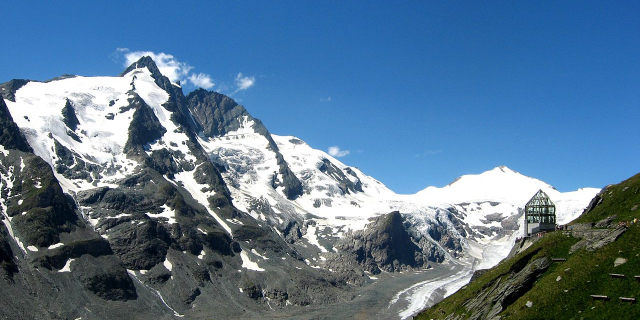
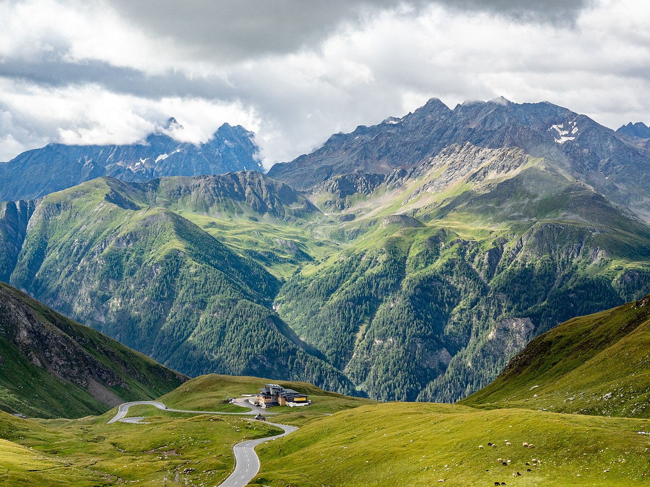
 A panoramic view of Grossglockner High Alpine Road, close to Kaiser-Franz-Josefs-Höhe (The road descends across the left peak, passing the center buildings, and winding back downhill at the end of the lake, to follow along the right bank.)


![[node:title]](/sites/default/files/styles/640x320/public/default_images/default_0.JPG?itok=nAKl_DR1)


Add new comment