Isle of Skye
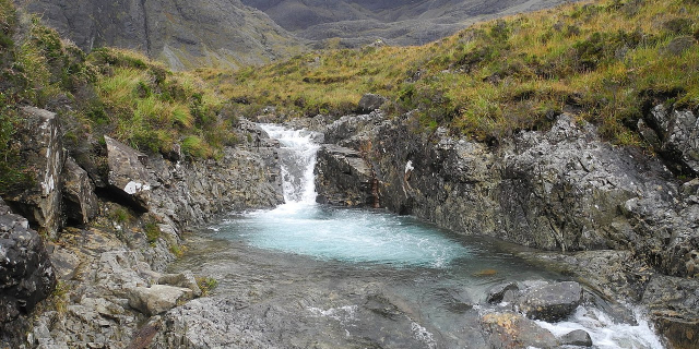
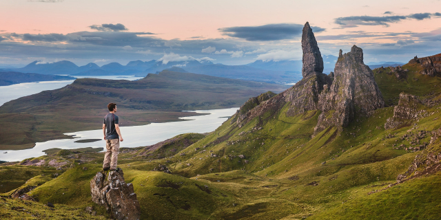
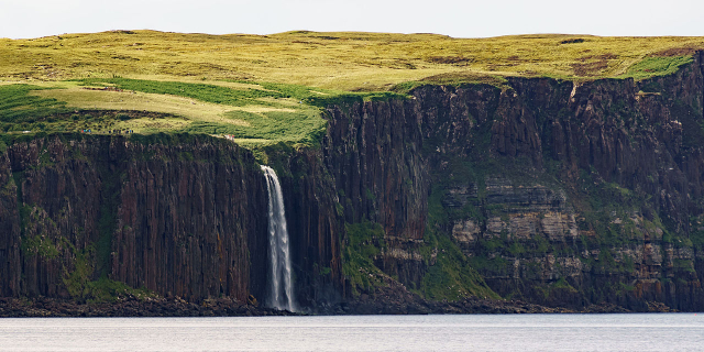
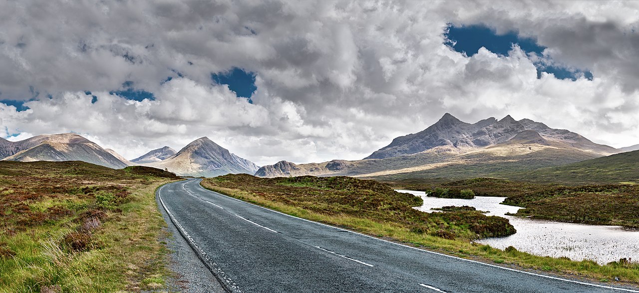
The Isle of Skye, or simply Skye (; Scottish Gaelic: An t-Eilean Sgitheanach or Eilean a' Cheò), is the largest and northernmost of the major islands in the Inner Hebrides of Scotland. The island's peninsulas radiate from a mountainous hub dominated by the Cuillin, the rocky slopes of which provide some of the most dramatic mountain scenery in the country. Although Sgitheanach has been suggested to describe a winged shape, no definitive agreement exists as to the name's origins.
The island has been occupied since the Mesolithic period, and over its history has been occupied at various times by Celtic tribes including the Picts and the Gaels, Scandinavian Vikings, and most notably the powerful integrated Norse-Gaels clans of MacLeod and MacDonald. The island was conside...Read more
The Isle of Skye, or simply Skye (; Scottish Gaelic: An t-Eilean Sgitheanach or Eilean a' Cheò), is the largest and northernmost of the major islands in the Inner Hebrides of Scotland. The island's peninsulas radiate from a mountainous hub dominated by the Cuillin, the rocky slopes of which provide some of the most dramatic mountain scenery in the country. Although Sgitheanach has been suggested to describe a winged shape, no definitive agreement exists as to the name's origins.
The island has been occupied since the Mesolithic period, and over its history has been occupied at various times by Celtic tribes including the Picts and the Gaels, Scandinavian Vikings, and most notably the powerful integrated Norse-Gaels clans of MacLeod and MacDonald. The island was considered to be under Norwegian suzerainty until the 1266 Treaty of Perth, which transferred control over to Scotland.
The 18th-century Jacobite risings led to the breaking-up of the clan system and later clearances that replaced entire communities with sheep farms, some of which involved forced emigrations to distant lands. Resident numbers declined from over 20,000 in the early 19th century to just under 9,000 by the closing decade of the 20th century. Skye's population increased by 4% between 1991 and 2001. About a third of the residents were Gaelic speakers in 2001, and although their numbers are in decline, this aspect of island culture remains important.
The main industries are tourism, agriculture, fishing, and forestry. Skye is part of the Highland Council local government area. The island's largest settlement is Portree, which is also its capital, known for its picturesque harbour. Links to various nearby islands by ferry are available, and since 1995, to the mainland by a road bridge. The climate is mild, wet, and windy. The abundant wildlife includes the golden eagle, red deer, and Atlantic salmon. The local flora is dominated by heather moor, and nationally important invertebrate populations live on the surrounding sea bed. Skye has provided the locations for various novels and feature films and is celebrated in poetry and song.
A Mesolithic hunter-gatherer site dating to the seventh millennium BC at An Corran in Staffin is one of the oldest archaeological sites in Scotland. Its occupation is probably linked to that of the rock shelter at Sand, Applecross, on the mainland coast of Wester Ross, where tools made of a mudstone from An Corran have been found. Surveys of the area between the two shores of the Inner Sound and Sound of Raasay have revealed 33 sites with potentially Mesolithic deposits.[1][2] Finds of bloodstone microliths on the foreshore at Orbost on the west coast of the island near Dunvegan also suggest Mesolithic occupation. These tools probably originated from the nearby island of Rùm.[3] Similarly, bloodstone from Rum, and baked mudstone, from the Staffin area, were found at the Mesolithic site of Camas Daraich, also from the seventh millennium BC, on the Point of Sleat, which has led archaeologists to believe that Mesolithic people on Skye would travel fairly significant distances, at least 70 km, both by land and sea.[4]
 The "Viking canal" at Rubha an Dùnain
Rubha an Dùnain, an uninhabited peninsula to the south of the Cuillin, has a variety of archaeological sites dating from the Neolithic onwards. A second- or third-millennium BC chambered cairn, an Iron Age promontory fort, and the remains of another prehistoric settlement dating from the Bronze Age are nearby. Loch na h-Airde on the peninsula is linked to the sea by an artificial "Viking" canal that may date from the later period of Norse settlement.[5][6] Dun Ringill is a ruined Iron Age hill fort on the Strathaird Peninsula, which was further fortified in the Middle Ages and may have become the seat of Clan MacKinnon.[7]
Early historyThe late Iron Age inhabitants of the northern and western Hebrides were probably Pictish, although the historical record is sparse.[8] Three Pictish symbol stones have been found on Skye and a fourth on Raasay.[9] More is known of the kingdom of Dál Riata to the south; Adomnán's life of Columba, written shortly before 697, portrays the saint visiting Skye (where he baptised a pagan leader using an interpreter[10]) and Adomnán himself is thought to have been familiar with the island.[11] The Irish annals record several events on Skye in the later seventh and early eighth centuries – mainly concerning the struggles between rival dynasties that formed the background to the Old Irish language romance Scéla Cano meic Gartnáin.[12]
Legendary hero Cú Chulainn is said to have trained on the Isle of Skye with warrior woman Scáthach.
The Norse held sway throughout the Hebrides from the 9th century until after the Treaty of Perth in 1266. However, apart from placenames, little remains of their presence on Skye in the written or archaeological record. Apart from the name "Skye" itself, all pre-Norse placenames seem to have been obliterated by the Scandinavian settlers.[13] Viking heritage, with Celtic heritage is claimed by Clan MacLeod. Norse tradition is celebrated in the winter fire festival at Dunvegan, during which a replica Viking longboat is set alight.[14]
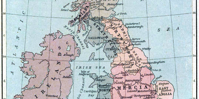
Clans and Scottish ruleThe most powerful clans on Skye in the post–Norse period were Clan MacLeod, originally based in Trotternish, and Clan Macdonald of Sleat. The isle was held by Donald Macdonald, Lord of the Isles’ half-brother, Godfrey, from 1389 until 1401, at which time Skye was declared part of Ross. When Donald Macdonald, Lord of the Isles, re-gained Ross after the battle of Harlaw in 1411, they added "Earl of Ross" to their lords' titles. Skye came with Ross.
Following the disintegration of the Lordship of the Isles in the late 15th century, Clan Mackinnon also emerged as an independent clan, whose substantial landholdings in Skye were centred on Strathaird.[15] Clan MacNeacail also have a long association with Trotternish,[16] and in the 16th century many of the MacInnes clan moved to Sleat.[17] The MacDonalds of South Uist were bitter rivals of the MacLeods, and an attempt by the former to murder church-goers at Trumpan Church in retaliation for a previous massacre on Eigg, resulted in the Battle of the Spoiling Dyke of 1578.[18]
 Skye as shown on Blaeu's 1654 Atlas of Scotland
After the failure of the Jacobite rebellion of 1745, Flora MacDonald became famous for rescuing Prince Charles Edward Stuart from the Hanoverian troops. Although she was born in South Uist, her story is strongly associated with their escape via Skye, and she is buried at Kilmuir in Trotternish.[19] Samuel Johnson and James Boswell's visit to Skye in 1773 and their meeting with Flora MacDonald in Kilmuir is recorded in Boswell's The Journal of a Tour to the Hebrides. Boswell wrote, "To see Dr. Samuel Johnson, the great champion of the English Tories, salute Miss Flora MacDonald in the isle of Sky, [sic] was a striking sight; for though somewhat congenial in their notions, it was very improbable they should meet here".[20] Johnson's words that Flora MacDonald was "A name that will be mentioned in history, and if courage and fidelity be virtues, mentioned with honour" are written on her gravestone.[21] After this rebellion, the clan system was broken up and Skye became a series of landed estates.[22]
Of the island in general, Johnson observed:
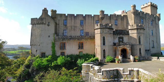
 Dunvegan Castle, looking towards MacLeod's Tables
I never was in any house of the islands, where I did not find books in more languages than one, if I staid long enough to want them, except one from which the family was removed. Literature is not neglected by the higher rank of the Hebrideans. It need not, I suppose, be mentioned, that in countries so little frequented as the islands, there are no houses where travellers are entertained for money. He that wanders about these wilds, either procures recommendations to those whose habitations lie near his way, or, when night and weariness come upon him, takes the chance of general hospitality. If he finds only a cottage he can expect little more than shelter; for the cottagers have little more for themselves but if his good fortune brings him to the residence of a gentleman, he will be glad of a storm to prolong his stay. There is, however, one inn by the sea-side at Sconsor, in Sky, where the post-office is kept.
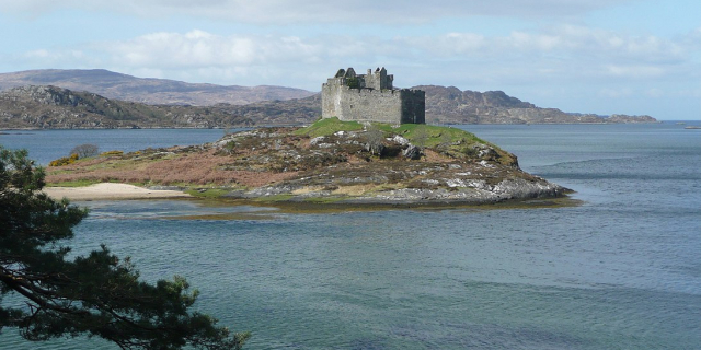
Skye has a rich heritage of ancient monuments from this period. Dunvegan Castle has been the seat of Clan MacLeod since the 13th century. It contains the Fairy Flag and is reputed to have been inhabited by a single family for longer than any other house in Scotland.[24] The 18th-century Armadale Castle, once the home of Clan Donald of Sleat, was abandoned as a residence in 1925, but now hosts the Clan Donald Centre.[25] Nearby are the ruins of two more MacDonald strongholds, Knock Castle, and Dunscaith Castle (called "Fortress of Shadows"), the legendary home of warrior woman, martial arts instructor (and, according to some sources, Queen) Scáthach.[26][27] Caisteal Maol, a fortress built in the late 15th century near Kyleakin and once a seat of Clan MacKinnon, is another ruin.[7]
Economic turmoil and mass emigration Ruins in the cleared landscape of Tusdale, was once so populous, it was nicknamed "the capital of Skye".[28][29]
In the late 18th century the harvesting of kelp became a significant activity,[30] but from 1822 onward cheap imports led to a collapse of this industry throughout the Hebrides.[31] During the 19th century, the inhabitants of Skye were also devastated by famine and Clearances. Thirty thousand people were evicted between 1840 and 1880 alone, many of them forced to emigrate to the New World.[32][33] The "Battle of the Braes" involved a demonstration against a lack of access to land and the serving of eviction notices. The incident involved numerous crofters and about 50 police officers. This event was instrumental in the creation of the Napier Commission, which reported in 1884 on the situation in the Highlands. Disturbances continued until the passing of the 1886 Crofters' Act and on one occasion 400 marines were deployed on Skye to maintain order.[34] The ruins of cleared villages can still be seen at Lorgill, Boreraig and Suisnish in Strath Swordale,[35][36] and Tusdale on Minginish.[29][37]
Overview of population trends Year 1755 1794 1821 1841 1881 1891 1931 1951 1961 1971 1981 1991 2001 2011 2017 Population[38][26][39] 11,252 14,470 20,827 23,082 16,889 15,705 9,908 8,537 7,479 7,183 7,276 8,847 9,232 10,008 13,143As with many Scottish islands, Skye's population peaked in the 19th century and then declined under the impact of the Clearances and the military losses in the First World War. From the 19th century until 1975 Skye was part of the county of Inverness-shire, but the crofting economy languished and according to Slesser, "Generations of UK governments have treated the island people contemptuously"[40] --a charge that has been levelled at both Labour and Conservative administrations' policies in the Highlands and Islands.[41][Note 1] By 1971 the population was less than a third of its peak recorded figure in 1841. However, the number of residents then grew by over 28 percent in the thirty years to 2001.[26] The changing relationship between the residents and the land is evidenced by Robert Carruthers's remark c. 1852, "There is now a village in Portree containing three hundred inhabitants." Even if this estimate is inexact the population of the island's largest settlement has probably increased sixfold or more since then.[44] During the period the total number of island residents has declined by 50 percent or more.[26][Note 2]The island-wide population increase of 4 percent between 1991 and 2001 occurred against the background of an overall reduction in Scottish island populations of 3 percent for the same period.[46] By 2011 the population had risen a further 8.4% to 10,008[38] with Scottish island populations as a whole growing by 4% to 103,702.[47]
Cite error: There are <ref group=Note> tags on this page, but the references will not show without a {{reflist|group=Note}} template (see the help page).


![[node:title]](/sites/default/files/styles/640x320/public/default_images/default_0.JPG?itok=nAKl_DR1)


Add new comment