Pacific Crest Trail
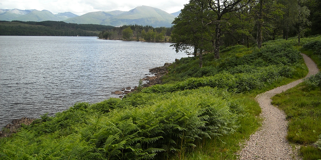
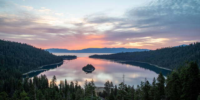
The Pacific Crest Trail (PCT), officially designated as the Pacific Crest National Scenic Trail, is a long-distance hiking and equestrian trail closely aligned with the highest portion of the Cascade and Sierra Nevada mountain ranges, which lie 100 to 150 miles (160 to 240 km) east of the U.S. Pacific coast. The trail's southern terminus is next to the Mexico–United States border, just south of Campo, California, and its northern terminus is on the Canada–US border, upon which it continues unofficially to the Windy Joe Trail within Manning Park in British Columbia; it passes through the states of California, Oregon, and Washington.
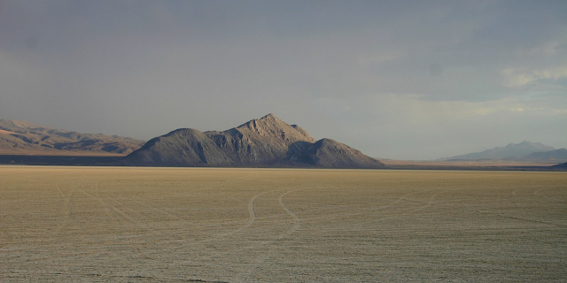
The Pacific Crest Trail is 2,653 mi (4,270 km) long and ranges in elevation from roughly 110 feet (34 m) above sea level near the Bridge of the Gods on the Oregon–Washington border to 13,153 feet (4,009 m) at Forester Pass in the Sierra Nevada. The route passes through 25 national forests and 7 national p...Read more
The Pacific Crest Trail (PCT), officially designated as the Pacific Crest National Scenic Trail, is a long-distance hiking and equestrian trail closely aligned with the highest portion of the Cascade and Sierra Nevada mountain ranges, which lie 100 to 150 miles (160 to 240 km) east of the U.S. Pacific coast. The trail's southern terminus is next to the Mexico–United States border, just south of Campo, California, and its northern terminus is on the Canada–US border, upon which it continues unofficially to the Windy Joe Trail within Manning Park in British Columbia; it passes through the states of California, Oregon, and Washington.
The Pacific Crest Trail is 2,653 mi (4,270 km) long and ranges in elevation from roughly 110 feet (34 m) above sea level near the Bridge of the Gods on the Oregon–Washington border to 13,153 feet (4,009 m) at Forester Pass in the Sierra Nevada. The route passes through 25 national forests and 7 national parks. Its midpoint is near Chester, California (near Mt. Lassen), where the Sierra and Cascade mountain ranges meet. The overall elevation gain for the Pacific Crest Trail is approximately 489,000 ft (149,000 m).
It was designated a National Scenic Trail in 1968, although it was not officially completed until 1993. The PCT was conceived by Clinton Churchill Clarke in 1932. It received official status under the National Trails System Act of 1968.
The Pacific Crest Trail, the Appalachian Trail, and the Continental Divide Trail form what is known as the Triple Crown of Hiking in the United States. The Pacific Crest Trail is also part of the 6,875-mile Great Western Loop.
The Pacific Crest Trail was first proposed around 1932 by Clinton C. Clarke as a trail running from Mexico to Canada along the crest of the mountains in California, Oregon, and Washington. The original proposal was to link the John Muir Trail, the Tahoe–Yosemite Trail (both in California), the Skyline Trail (in Oregon) and the Cascade Crest Trail (in Washington).[1]
The Pacific Crest Trail System Conference was formed by Clarke to both plan the trail and to lobby the federal government to protect the trail. The conference was founded by Clarke, the Boy Scouts, the YMCA, and Ansel Adams (amongst others). From 1935 through 1938, YMCA groups explored the 2,000 miles of potential trail and planned a route, which has been closely followed by the modern PCT route.[1]
In recent years, Washington state clubwoman and educator Catherine T. Montgomery's contributions to the initial concept of the Pacific Crest Trail have been explored and she is known as the "Mother of the Pacific Crest Trail".[2]
In 1968, President Lyndon B. Johnson defined the PCT and the Appalachian Trail with the National Trails System Act. The PCT was then constructed through cooperation between the federal government and volunteers organized by the Pacific Crest Trail Association. In 1993, the PCT was officially declared finished.[1]
The Trust for Public Land has purchased and conserved more than 3,000 acres (12 km2) along the Pacific Crest Trail in Washington.[3] Consolidation of this land has allowed for better recreational access as well as greater ease to manage conservation lands.[3]
A bicycle touring route has been developed to parallel the PCT on paved and unpaved roads.[4][5]


 - Public domain")


Add new comment