Chaco Culture National Historical Park
Chaco Culture National Historical Park is a United States National Historical Park in the American Southwest hosting a concentration of pueblos. The park is located in northwestern New Mexico, between Albuquerque and Farmington, in a remote canyon cut by the Chaco Wash. Containing the most sweeping collection of ancient ruins north of Mexico, the park preserves one of the most important pre-Columbian cultural and historical areas in the United States.
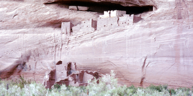
Between AD 900 and 1150, Chaco Canyon was a major center of culture for the Ancestral Puebloans. Chacoans quarried sandstone blocks and hauled timber from great distances, assembling fifteen major complexes that remained the largest buildings ever built in North America until the 19th century. Evidence of archaeoastronomy at Chaco has been proposed, with the "Sun Dagger" petroglyph at Fajada Butte a popular ex...Read more
Chaco Culture National Historical Park is a United States National Historical Park in the American Southwest hosting a concentration of pueblos. The park is located in northwestern New Mexico, between Albuquerque and Farmington, in a remote canyon cut by the Chaco Wash. Containing the most sweeping collection of ancient ruins north of Mexico, the park preserves one of the most important pre-Columbian cultural and historical areas in the United States.
Between AD 900 and 1150, Chaco Canyon was a major center of culture for the Ancestral Puebloans. Chacoans quarried sandstone blocks and hauled timber from great distances, assembling fifteen major complexes that remained the largest buildings ever built in North America until the 19th century. Evidence of archaeoastronomy at Chaco has been proposed, with the "Sun Dagger" petroglyph at Fajada Butte a popular example. Many Chacoan buildings may have been aligned to capture the solar and lunar cycles, requiring generations of astronomical observations and centuries of skillfully coordinated construction. Climate change is thought to have led to the emigration of Chacoans and the eventual abandonment of the canyon, beginning with a fifty-year drought commencing in 1130.
A UNESCO World Heritage Site located in the arid and sparsely populated Four Corners region, the Chacoan cultural sites are fragile—concerns of erosion caused by tourists have led to the closure of Fajada Butte to the public. The sites are considered sacred ancestral homelands by the Hopi and Pueblo people, who maintain oral accounts of their historical migration from Chaco and their spiritual relationship to the land. Although park preservation efforts can conflict with native religious beliefs, tribal representatives work closely with the National Park Service to share their knowledge and respect the heritage of the Chacoan culture.
The park is on the Trails of the Ancients Byway, one of the designated New Mexico Scenic Byways.
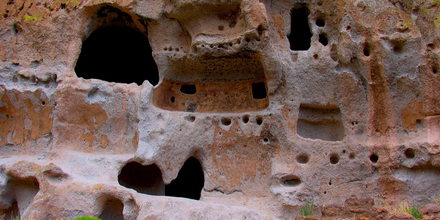
The first people in the San Juan Basin were hunter-gatherers: the Archaic–Early Basketmaker people. These small bands descended from nomadic Clovis big-game hunters who arrived in the Southwest around 10,000 BC.[1] More than 70 campsites from this period, carbon-dated to the period 7000–1500 BC and mostly consisting of stone chips and other leavings, were found in Atlatl Cave and elsewhere within Chaco Canyon, with at least one of the sites located on the canyon floor near an exposed arroyo. The Archaic–Early Basketmaker people were nomadic or semi-nomadic hunter-gatherers who over time began making baskets to store gathered plants. By the end of the period, some people cultivated food. Excavation of their campsites and rock shelters has revealed that they made tools, gathered wild plants, and killed and processed game. Slab-lined storage cists indicate a change from a wholly nomadic lifestyle.[2]
Ancestral Puebloans
By 900 BC, Archaic people lived at Atlatl Cave and similar sites.[3] They left little evidence of their presence in Chaco Canyon. By AD 490, their descendants, of the Late Basketmaker II Era, farmed lands around Shabik'eshchee Village and other pit-house settlements at Chaco.[citation needed]
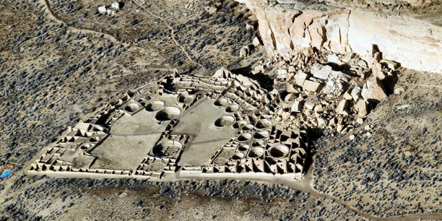
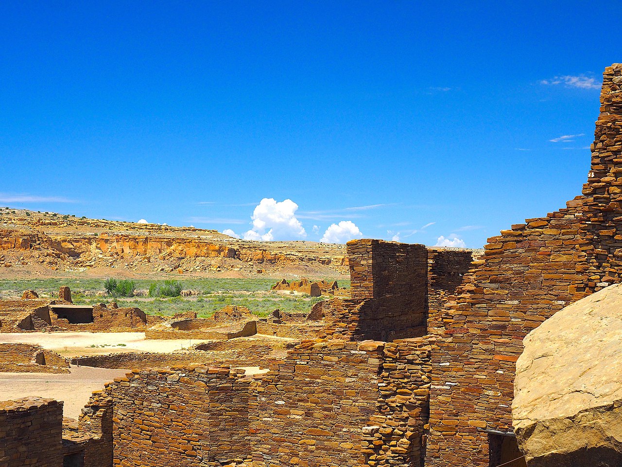
A small population of Basketmakers remained in the Chaco Canyon area. The broad arc of their cultural elaboration culminated around 800, during the Pueblo I Era, when they were building crescent-shaped stone complexes, each comprising four to five residential suites abutting subterranean kivas,[4] large enclosed areas reserved for rites. Such structures characterize the Early Pueblo People. By 850, the Ancient Pueblo population—the "Anasazi", from a Ute term adopted by the Navajo denoting the "ancient ones" or "enemy ancestors"—had rapidly expanded: groups resided in larger, more densely populated pueblos. Strong evidence attests to a canyon-wide turquoise processing and trading industry dating from the tenth century. Around then, the first section of Pueblo Bonito was built: a curved row of 50 rooms near its present north wall.[5][6] Archaeogenomic analysis of the mitochondria of nine skeletons from high-status graves in Pueblo Bonito determined that members of an elite matriline were interred here for approximately 330 years between 800 and 1130, suggesting continuity with the matrilineal succession practices of many Pueblo nations today.[7]
The cohesive Chacoan system began unravelling around 1140, perhaps triggered by an extreme fifty-year drought that began in 1130;[8] chronic climatic instability, including a series of severe droughts, again struck the region between 1250 and 1450.[9] Poor water management led to arroyo cutting; deforestation was extensive and economically devastating:[10][11][12] timber for construction had to be hauled instead from outlying mountain ranges such as the Chuska mountains, which are more than 50 miles (80 km) to the west.[13] Outlying communities began to depopulate and, by the end of the century, the buildings in the central canyon had been neatly sealed and abandoned.[citation needed]
Some scholars suggest that violence and warfare, perhaps involving cannibalism, impelled the evacuations. Hints of such include dismembered bodies—dating from Chacoan times—found at two sites within the central canyon.[14] Yet Chacoan complexes showed little evidence of being defended or defensively sited high on cliff faces or atop mesas. Only several minor sites at Chaco have evidence of the large-scale burning that would suggest enemy raids.[15] Archaeological and cultural evidence leads scientists to believe people from this region migrated south, east, and west into the valleys and drainages of the Little Colorado River, the Rio Puerco, and the Rio Grande.[16] Anthropologist Joseph Tainter deals at length with the structure and decline of Chaco civilization in his 1988 study The Collapse of Complex Societies.[17]
Athabaskan succession![Large square map of northwestern New Mexico and neighboring parts of, clockwise from left, western Arizona, southeastern Utah, and southwestern Colorado. The map region has a green and blocky rectangular-crescent area at its center labeled "Chaco Culture National Historical Park". Radiating from the green region are seven segmented gold lines: "[p]rehistoric roads", each several dozen kilometers in length when measured according to the map scale factor. Roughly seventy red dots mark the location of "Great House[s]"; they are widely spread across the map, many of them far from the green area, near the extremes of the map, more than one hundred kilometers from the green area. Two proceed roughly south, one southwest, one northwest, one straight north, and the last to the southeast. Yellow dots mark the location of modern settlements: "Shiprock", "Cortez", "Farmington", and "Aztec" to the northwest and north; "Nageezi", "Cuba", and "Pueblo Pintado" to the northeast and east; "Grants", "Crownpoint", and "Gallup" to the south and southwest. They are connected by a network of gray lines marking various interstate and state highways. A fan of thin blue lines along the northern margins of the map depict the San Juan River and its communicants.](http://upload.wikimedia.org/wikipedia/commons/thumb/6/6a/Prehistoric-Roads.jpg/350px-Prehistoric-Roads.jpg) Prehistoric roads and great houses in the San Juan Basin, superimposed on a map showing modern roads and settlements
Prehistoric roads and great houses in the San Juan Basin, superimposed on a map showing modern roads and settlementsNumic-speaking peoples, such as the Ute and Shoshone, were present on the Colorado Plateau beginning in the 12th century. Nomadic Southern Athabaskan-speaking peoples, such as the Apache and Navajo, succeeded the Pueblo people in this region by the 15th century. In the process, they acquired Chacoan customs and agricultural skills.[16][18] Ute tribal groups also frequented the region, primarily during hunting and raiding expeditions. The modern Navajo Nation lies west of Chaco Canyon, and many Navajo live in surrounding areas.[19]
Excavation and protectionThe first documented trip through Chaco Canyon was an 1823 expedition led by New Mexican governor José Antonio Vizcarra when the area was under Mexican rule. He noted several large ruins in the canyon.[20] The American trader Josiah Gregg wrote about the ruins of Chaco Canyon, referring in 1832 to Pueblo Bonito as "built of fine-grit sandstone". In 1849, a U.S. Army detachment passed through and surveyed the ruins, following United States acquisition of the Southwest with its victory in the Mexican War in 1848.[21] The canyon was so remote, however, that it was scarcely visited over the next 50 years. After brief reconnaissance work by Smithsonian scholars in the 1870s, formal archaeological work began in 1896 when a party from the American Museum of Natural History based in New York City—the Hyde Exploring Expedition—began excavating Pueblo Bonito. Spending five summers in the region, they sent more than 60,000 artifacts back to New York and operated a series of trading posts in the area.[22]
In 1901 Richard Wetherill, who had worked for the Hyde expedition, claimed a homestead of 161 acres (65 ha) that included Pueblo Bonito, Pueblo del Arroyo, and Chetro Ketl.[23][24] While investigating Wetherill's land claim, federal land agent Samuel J. Holsinger detailed the physical setting of the canyon and the sites, noted prehistoric road segments and stairways above Chetro Ketl, and documented prehistoric dams and irrigation systems.[25][26][26] His report went unpublished and unheeded. It urged the creation of a national park to safeguard Chacoan sites.
The next year, Edgar Lee Hewett, president of New Mexico Normal University (later renamed New Mexico Highlands University), mapped many Chacoan sites. Hewett and others helped enact the Federal Antiquities Act of 1906, the first U.S. law to protect relics; it was, in effect, a direct consequence of Wetherill's controversial activities at Chaco (including amateur excavations, reuse of ruin materials for building, and a large livestock ranching operation).[27] The Act also authorized the President to establish national monuments: on March 11, 1907, Theodore Roosevelt proclaimed Chaco Canyon National Monument. Wetherill relinquished his land claims.[2]
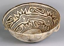 A ceramic bowl excavated from Pueblo Alto, dating from AD 1030 to 1200
In 1920, the National Geographic Society began an archaeological examination of Chaco Canyon and appointed Neil Judd, then 32, to head the project. After a reconnaissance trip that year, Judd proposed to excavate Pueblo Bonito, the largest ruin at Chaco. Beginning in 1921, Judd spent seven field seasons at Chaco. Living and working conditions were spartan at best. In his memoirs, Judd noted dryly that "Chaco Canyon has its limitations as a summer resort". By 1925, Judd's excavators had removed 100,000 short tons of overburden, using a team of "35 or more Indians, ten white men, and eight or nine horses". Judd's team found only 69 hearths in the ruin, a puzzling discovery as winters are cold at Chaco.[28] Judd sent A. E. Douglass more than 90 specimens for tree-ring dating, then in its infancy. At that time, Douglass had only a "floating" chronology. it was not until 1929 that a Judd-led team found the "missing link". Most of the beams used at Chaco were cut between 1033 and 1092, the height of construction there.[28]
In 1949, the University of New Mexico deeded over adjoining lands to form an expanded Chaco Canyon National Monument. In return, the university maintained scientific research rights to the area. By 1959, the National Park Service had constructed a park visitor center, staff housing, and campgrounds. As a historic property of the National Park Service, the National Monument was listed on the National Register of Historic Places on October 15, 1966. In 1971, researchers Robert Lister and James Judge established the "Chaco Center", a division for cultural research that functioned as a joint project between the University of New Mexico and the National Park Service. A number of multi-disciplinary research projects, archaeological surveys, and limited excavations began during this time. The Chaco Center extensively surveyed the Chacoan roads, well-constructed and strongly reinforced thoroughfares radiating from the central canyon.[29]
The richness of the cultural remains at park sites led to the expansion of the small National Monument into the Chaco Culture National Historical Park on December 19, 1980, when an additional 13,000 acres (5,300 ha) were added to the protected area. In 1987, the park was designated a World Heritage Site by UNESCO. To safeguard Chacoan sites on adjacent Bureau of Land Management and Navajo Nation lands, the Park Service developed the multi-agency Chaco Culture Archaeological Protection Site program. These initiatives have identified more than 2,400 archeological sites within the current park's boundaries; only a small percentage of these have been excavated.[29][30]


 - Public domain")

 - CC BY-SA 2.0")


Add new comment