Llanfairpwllgwyngyll
Llanfairpwllgwyngyll, or Llanfair Pwllgwyngyll (Welsh: [ɬan.ˌvair.puɬˈɡwɨ̞n.ɡɨ̞ɬ]), is a village and community on the Isle of Anglesey, Wales. It is located on the Menai Strait, next to the Britannia Bridge. At the 2011 Census the population was 3,107, of whom 71% could speak Welsh. It is the sixth largest settlement in the county by population.
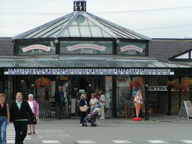
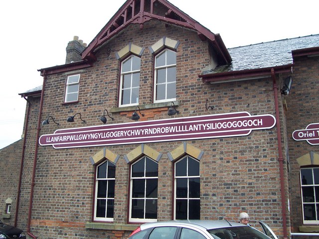
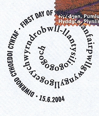
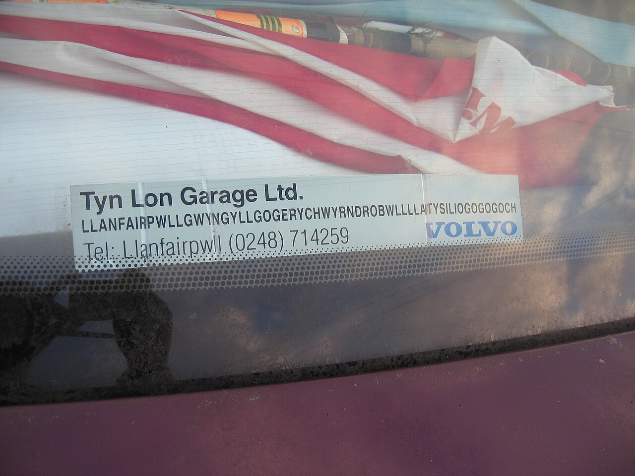
In some contexts the name of the community is lengthened to Llanfairpwllgwyngyllgogerychwyrndrobwllllantysiliogogogoch ([ˌɬan.vair.pʊɬ.ˌɡwɨ̞ŋ.ɡɨ̞ɬ.ɡɔ.ˌɡɛ.rə.ˌχwərn.ˌdrɔ.bʊɬ.ˌɬan.tə.ˌsɪl.jɔˌɡɔ.ɡɔ.ˈɡoːχ] ). With 58 characters split into 18 syllables, it is purported to be the longest place name in Europe and the second longest one-word place name in the world.
 The Marquess of Anglesey's Column, designed by Thomas Harrison, celebrating the heroism of Henry Paget, 1st Marquess of Anglesey at the Battle of Waterloo. At 27 metres (89 ft) high, it offers views over Anglesey and the Menai Strait.
There has been human activity and settlement in the area of the village since the Neolithic era (4000–2000 BC), with subsistence agriculture and fishing the most common occupations for much of its early history. The island of Anglesey was at that point reachable only by boat across the Menai Strait. A largely destroyed, collapsed dolmen can be found from this period in the parish, located at Ty Mawr north of the present-day church; early Ordnance Survey maps show a long cairn on the site.[1] The probable remains of a hillfort, with a fragmentary bank and ditch, were recorded on an outcrop known as Craig y Ddinas.[2]
The area was briefly invaded and captured by the Romans under Gaius Suetonius Paulinus, temporarily abandoned in order to consolidate forces against Boudicca, then held until the end of Roman Britain.
With the withdrawal of the Roman forces, the area fell under the control of the early medieval Kingdom of Gwynedd. There has likely been a small Christian religious site, perhaps a monastic cell, in the area since the 7th century.[3] Surveys of the later medieval period show that the tenants of the township of Pwllgwyngyll, as it was then known, held a total of 9 bovates of land from the Bishop of Bangor under the feudal system.[4] A church was built during the medieval period and dedicated to Mary, probably under Norman influence: the building, later demolished and replaced by a Victorian-era church, was unusual in having a semi-circular apse, a feature more usually associated with cathedrals.[5] Despite religious activity, the rural nature of the settlement meant that the parish had a population of only around 80 in 1563.
Much of the land was absorbed into the Earldom of Uxbridge, which later became the Marquisate of Anglesey, and was subject to enclosures. In 1844, for example, 92% of the land in Llanfairpwll was owned by just three individuals. The population of the parish reached 385 by 1801.
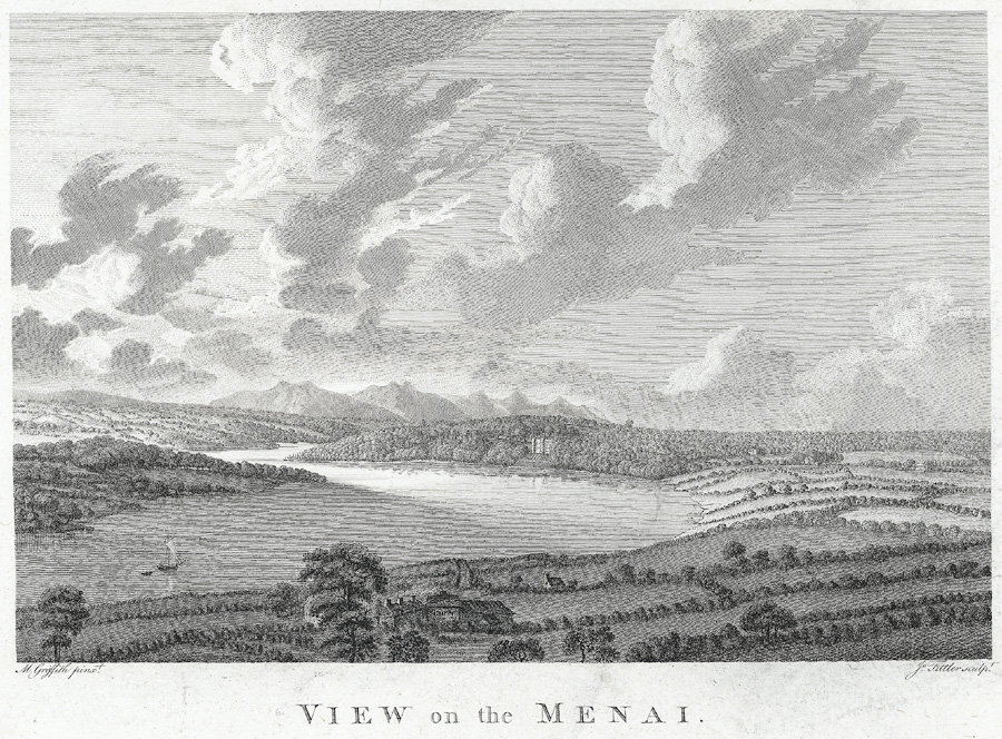
In 1826, Anglesey was connected to the rest of Wales by the construction of the Menai Suspension Bridge by Thomas Telford, and connected with London in 1850 with the building of the Britannia Bridge and the busy North Wales Coast railway line, which connected the rest of Great Britain to the ferry port of Holyhead. The old village, known as 'Pentre Uchaf' ("upper village") was joined by new development around the railway station, which became known as 'Pentre Isaf', the "lower village".
The first meeting of the Women's Institute took place in Llanfairpwll in 1915, and the movement (which began in Canada) then spread through the rest of the British Isles.[6]


 - CC BY-SA 2.0")


![[node:title]](/sites/default/files/styles/640x320/public/default_images/default_0.JPG?itok=nAKl_DR1)

Add new comment